Commercial Redevelopment Of A Former Research & Development Complex, Barhill Drive, Malpas, Cheshire SY13
Case Study Reference: CS23-03-07
Planning Authority: Cheshire West and Chester Council
Planning Reference: https://www.cheshirewestandchester.gov.uk/residents/planning-and-building-control/see-or-comment-on-planning-applications and https://pa.cheshirewestandchester.gov.uk/online-applications/applicationDetails.do?previousCaseType=Application&keyVal=P9AIL4TEMUX00&previousCaseNumber=22%2F02109%2FDIS&activeTab=summary&previousKeyVal=RD2CCCTEN5700
Synopsis:
Given the history of the site a contaminated land planning condition was attached to the decision notice for the proposed development.
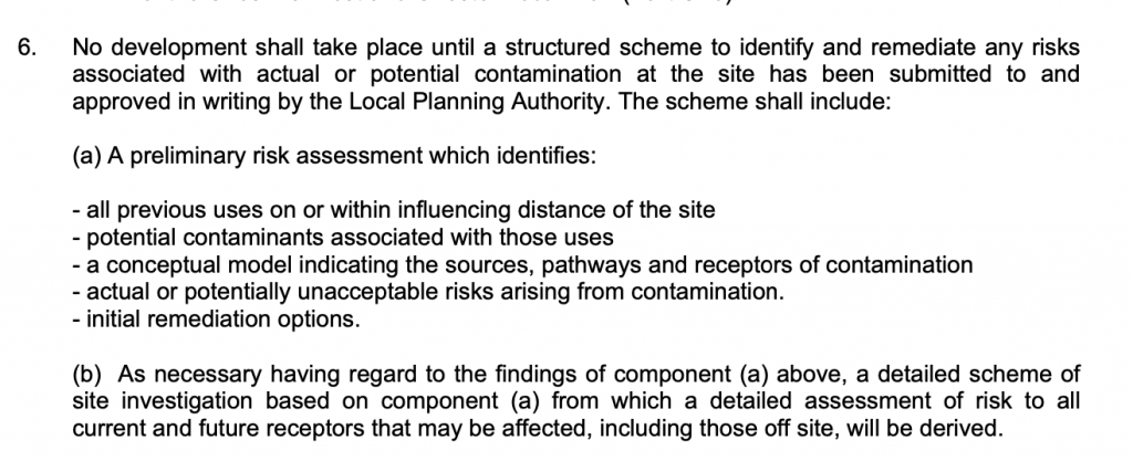
The first stage of discharging the condition (part and b) was to prepare a Phase I desk study report in order to determine if the site has the potential to be impacted by elevated levels of contamination, and to determine the source as well as the likelihood of the risk occurring.
 A desk study determines what issues relating to historical contamination may affect the site, this is undertaken by reviewing the site history using a combination of O.S. maps, aerial, plates and street level imagery, a review of data held by regulatory bodies (Environment Agency, local authority, BGS etc.) as well as a site walkover survey.
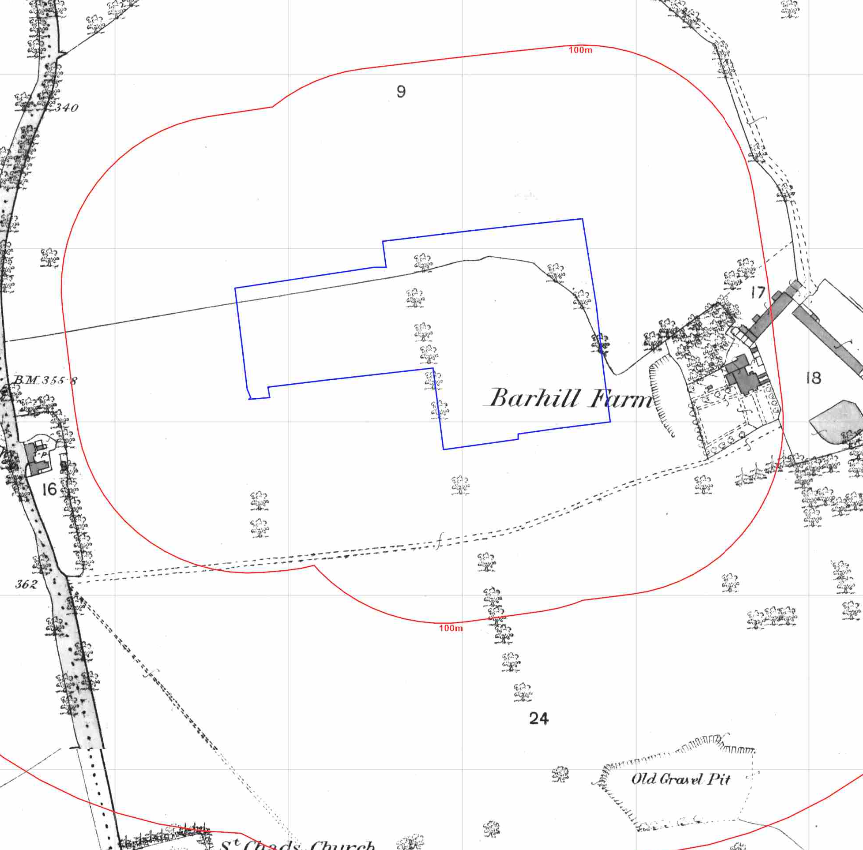
The history of the site and surrounds were researched using a combination of Ordnance Survey (O.S.) maps, street level imagery and aerial plates, this revealed the site was developed between 1949 and 1971, subsequent maps identify the site as ‘Barhill Development Farm’.
A tank was identified on the 1971 map 10m south of the site as well as two excavations on the 1874 map 25m east and 185m south east of the site.
Aerial plates indicated the buildings on the site were agricultural.
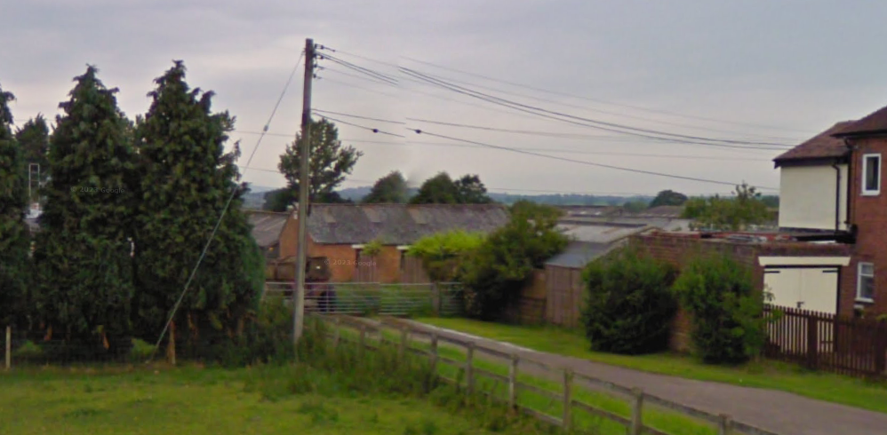
Street level imagery of the site also confirmed the buildings appeared to be agricultural.
The planning history of the site was reviewed as part of the desk based research and reports associated with any previous application were located and studied and three applications for the site were noted, including 22/02109/DIS which included a Phase I report for the subject site. The report was reviewed and no additional information was sourced.
 The published geological maps identified the site being in an area where the drift soils were recorded as Devensian Till. The bedrock was given as Sidmouth Mudstone Formation of the Olenekian epoch.
Data provided by the Coal Authority indicated that the site is not within a “Development High Risk Area”.
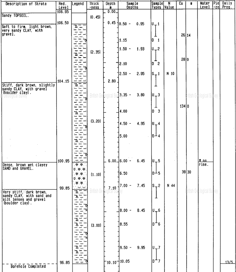
A review of the borehole records held by the BGS revealed a borehole record available on the eastern boundary, made ground was not recorded and clay was proven to 10mbgl.
Data provided by regulatory bodies confirmed the presence of a gravel pit to the south east of the site which was identified on the O.S. maps. A number of waste exceptions were also noted to be registered to the site and an engineers was also present on the site.
The sensitivity of controlled waters was undertaken to determine if the site posed a risk to the nearby water bodies, this concluded that whilst the site was within a Source Protection Zone, as the bedrock was a secondary aquifer and was of low risk indicating the groundwater was not a credible receptor.
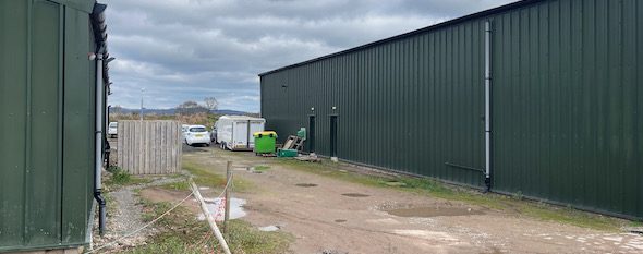
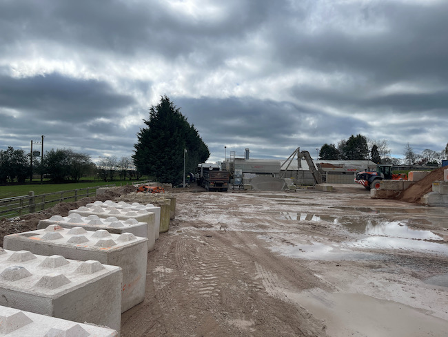 On completion of the desk based research a site reconnaissance visit was undertaken, this confirmed a number of buildings had been demolished prior to the site visit, the majority of the site was
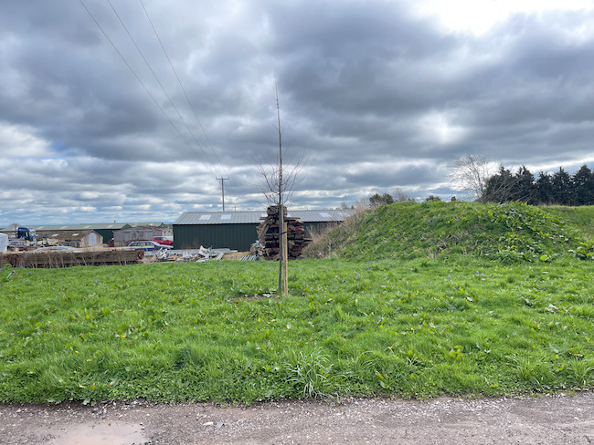 used to store building supplies and plant . Offices were present on the north eastern buildings with a disused poultry shed on the south eastern area.
As part of the site visit the areas of the excavations were inspected, no evidence of in-filling was noted (evidence of the depression similar to the outline on the (O.S. maps), this was used to discount the pit/excavation as credible sources of ground gases.
Once the walkover survey was completed a qualitative risk assessment was undertaken on the potential sources of contamination identified in the desk study report in order to determine if any warranted further investigation, this concluded that the potential risks form made ground and the past uses of the site required further investigation and assessment.
The report concluded that a site investigation was required and details of the investigation, including the rationale behind the locations of the sampling positions as well as the sampling regime were provided .
The Phase I report was submitted (22/02109/DIS) to partly discharge the contaminated land planning condition. The recommendations of the Phase I report were accepted and the desk study parts of the condition were discharged.