
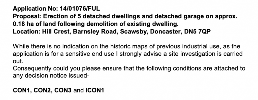
Residential Development, Barnsley Road, Scawsby, Doncaster, DN5
Planning Authority: Doncaster Metropolitan Borough Council
Planning Reference: 14/01076/FUL and 22/00238/COND
Synopsis:
As part of the planning process it has to be demonstrated that a site is suitable for its proposed use taking account of ground conditions and any risks arising from land instability and contamination as well as after remediation, as a minimum, land should not be capable of being determined as contaminated land under Part IIA of the Environmental Protection Act 1990.
Whilst the internal consultations did not identify and potential sources of contamination, given the sensitivity of the proposed development a contaminated land planning condition was attached to the decision notice.
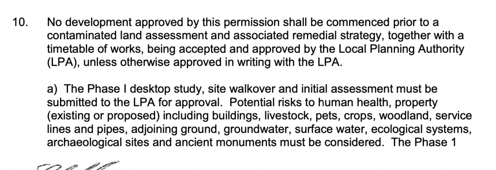
The first stage in discharging the contaminated land planning condition was to prepare a Phase I desk study report and have the recommendations accepted by the local authority.
 The history of the site and surrounds were researched using a
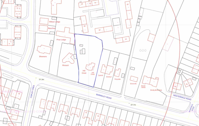 combination of Ordnance Survey (O.S.) maps, street level imagery and aerial plates. The review indicated the site was undeveloped until the late 1920’s, subsequent maps identified the building as ‘Hill Crest’.
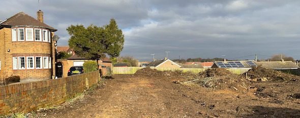
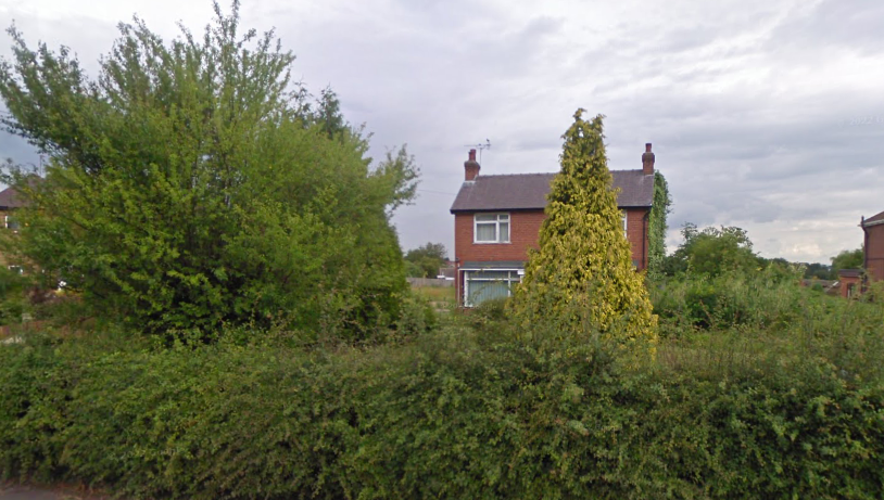
Aerial plates indicated the site had been cleared between 2013 and 2018, street level imagery narrowed the time to between 2015 and 2017.
The geological maps for the site revealed that drift deposits were not expected to be present on the site and the limestone bedrock would be present at the surface.
Consultations with British Geological Survey and Public Health England indicated the site was in an area where basic radon measures were required.

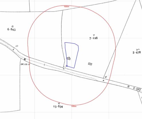
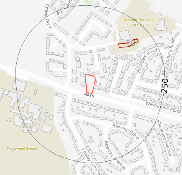 Data provided by regulatory bodies identified ground workings 135m north east of the site, the O.S. maps indicate the area was a change in level associated with the school next to the ‘workings’ and did not pose a risk to the proposed development.
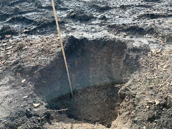
On completion of the desk based research a site reconnaissance 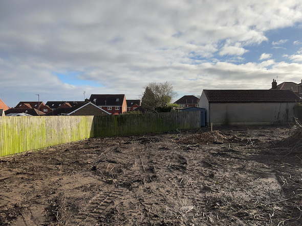 visit was undertaken, this revealed the site had been cleared, a number of trial pits that had been used for infiltration tests were present on the site, these provided further information on the ground conditions and confirmed the absence of deposits of made ground.
On completion of the walkover survey a qualitative risk assessment was undertaken on the potential sources of contamination identified in the desk study report in order to determine if any warranted further investigation, this concluded that the potential for the site to be affected by radon required further assessment and it was concluded that the incorporation of basic radon measures would be sufficient to break the pollution linkages associated with radon.
In order to discharge the contaminated land planning condition the Phase I report was submitted under reference 22/00238/COND
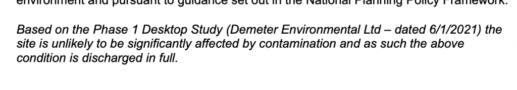
The report was accepted and the condition discharged.