

Replacement Agricultural Dwellings, Gautby Road, Bardney, Lincolnshire, LN8
Case Study Reference: 20-11-09
Planning Authority: West Lindsey District Council
Planning Reference: 138566 and 142152
Synopsis:
Given that the site was within the boundary as a former Raf airfield a contaminated land planning condition was attached to the decision notice for the proposed development.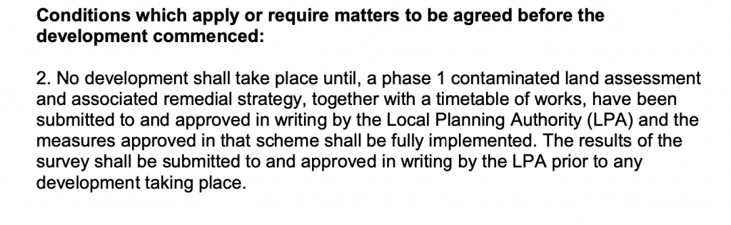

 The first part of the discharge of the contaminated land planning condition was to prepare a Phase I desk study report. This reviews the history of the site and the surrounds as well as reviewing information held by regulatory bodies (Environment Agency, British Geological Survey, HSE, Local Authority etc.) to determine what potential issues may be present on the site.

The site was identified as open land until the 1955 map when the site was identified a part of an airfield which the runways had been removed indicating the site was military. Subsequent maps identify the site as open land with the access forming part of the former runways and the area being used as poultry sheds.
Data held by regulatory bodies confirmed the site was a former airfield.
An internet search was undertaken in order to obtain more information on the uses of the site, which revealed the site formed part of RAF Bardney which was active between 1943 and 1945 (http://www.bcar.org.uk/bardney-history -) and that the site was used for vehicle storage and as a Thir missile site (http://www.controltowers.co.uk/B/Bardney.htm) .
On completion of the desk based survey a site walkover visit was undertaken, this confirmed that the site was open land within a former airfield.

On completion fo the walkover survey a qualitative risk assessment was undertaken in roder to determine if any of the potential sources posed a risk to end users, this concluded that the past use of the site as an RAF airbase and the potential for made ground on the site warranted further investigation.
The Phase I report was submitted to the planning authority (142152).

Once the recommendations in the Phase I report had been approved the Phase II site i
 nvestigation could commence, this comprised of the sinking of ten dynamic sampling boreholes across the site in order to determine if made ground was present and if there was any evidence of contamination.
The site investigation confirmed made ground was not present on the site and samples were subject to chemical analysis in order to demonstrate the past uses of the site have not impacted on the soils. The assessment of the chemical data concluded that the site soils did not pose a risk to end users (residents) or to controlled waters and nearby receptors.
The Phase II was also submitted under planning application 142152, confirmation the Phase II report is online.
