
Erection of a Dwelling, Ise View Road, Desborough, NN14
Case Study Reference: CS17-11-10
Planning Authority: Kettering Borough Council
Planning Reference: https://www.kettering.gov.uk/planningApplication/search and https://www.kettering.gov.uk/planningApplication/126759
Synopsis:
Given the sensitive nature of the development (residential) and the history of the site a contaminated land planning condition was attached to the decision notice for the proposed development.
The first stage of discharging the condition was to prepare a Phase I desk study report in order to determine if the site has the potential to be impacted by elevated levels of contamination, and to determine the source as well as the likelihood of the risk occurring.
 A desk study determines what issues relating to historical contamination may affect the site, this is undertaken by reviewing the site history using a combination of O.S. maps, aerial, plates and street level imagery, a review of data held by regulatory bodies (Environment Agency, local authority, BGS etc.) as well as a site walkover survey.
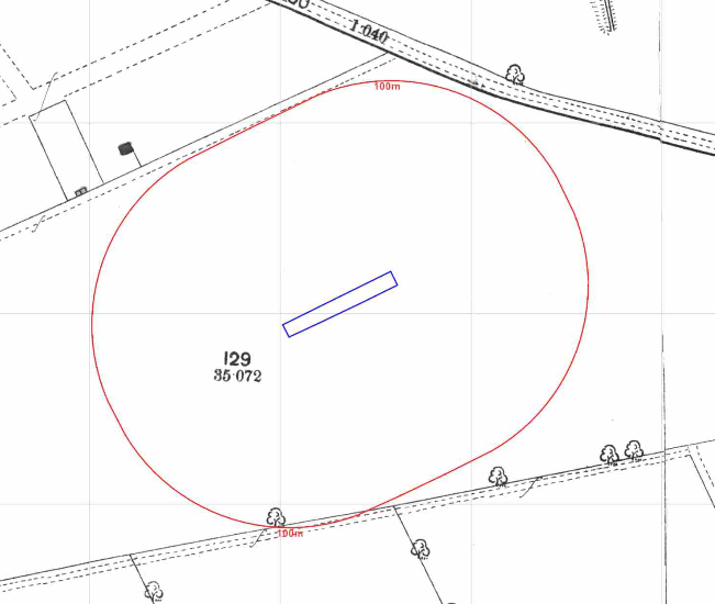
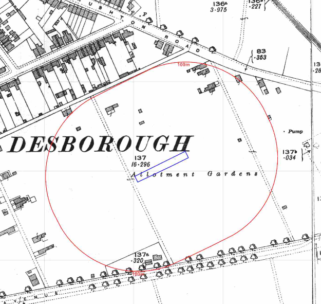
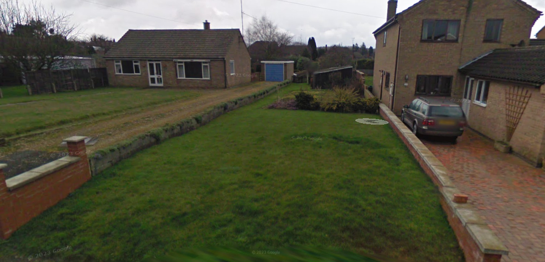
The history of the site and surrounds were researched using a combination of Ordnance Survey (O.S.) maps, street level imagery and aerial plates, this revealed the site was initially (1884) comprised of open land and by 1900 the site formed part of an allotment garden. The allotments were abandoned circa 1968 and by 1973 a dwelling was present on the site, which was demolished prior to the 1976 map. Aerial plates indicated the site was open.
A quarry was noted on the 1900 map 100m north of the site, which appears to have been in-filled circa 1968.
The planning history of the site was reviewed as part of the desk based research and reports associated with any previous application were located and studied and no previous applications were noted.
The published geological maps identified the site as being in an area where drift deposits were not present, the bedrock, the Northampton Sand Formation (Ooidal Ironstone) will be present at the surface.
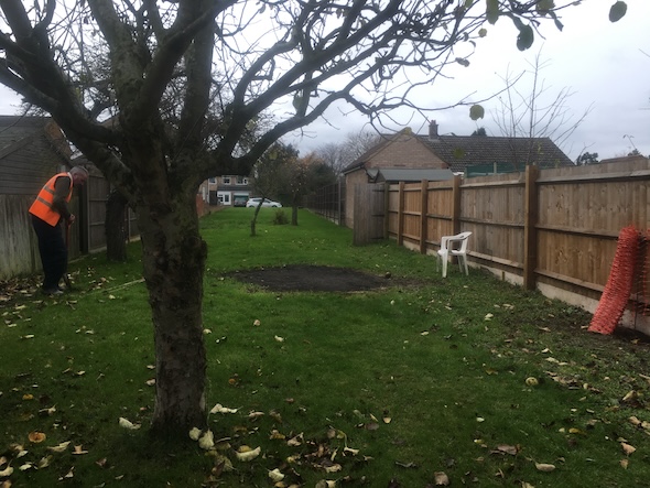
As part of the survey two hand held trial pits were excavated to determine if made ground was present and to obtain samples for chemical analysis (naturally occurring contaminants). The trial pkts were excavated to 0.2mbgl and made ground was not recorded in either location.
Background chemistry data provided by the BGS (British Geological Survey) indicated that concentrations of arsenic were close to the threshold for a residential end use.
Data provided by regulatory bodies identified a quarry to the north of the site (identified in the O.S. maps), a landfill in the same area as the quarry as well as a burial ground 200m south west.
The sensitivity of controlled waters was undertaken to determine if the site posed a risk to the nearby water bodies, this concluded that as the bedrock was a Secondary A aquifer and the site was not within a Source Protection Zone the groundwater was of low risk and further assessment was not warranted.
 On completion of the desk based research a site reconnaissance
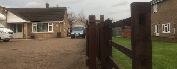
 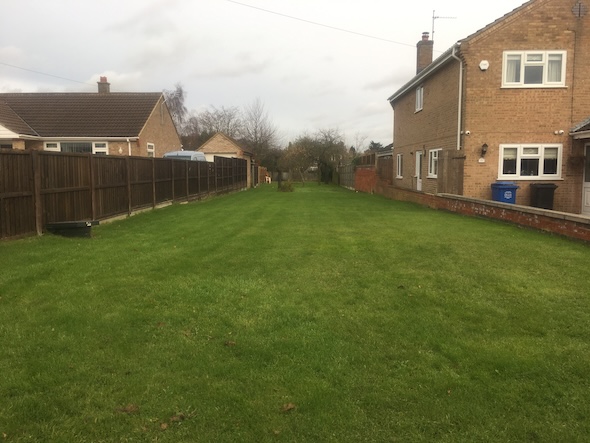 visit was undertaken, this confirmed the site comprised part of the garden of the adjoining property.
Che amical analysis of the site soils indicated the soils were impacted by arsenic and dibenz(ah)amthracene (PAH).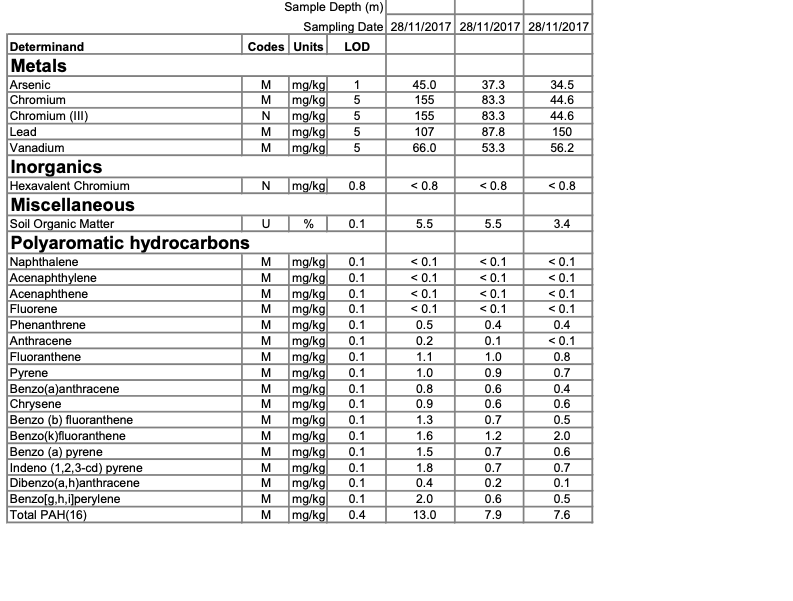
Once the walkover survey was completed a qualitative risk assessment was undertaken on the potential sources of contamination identified in the desk study report in order to determine if any warranted further investigation, this concluded 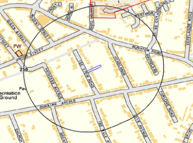 that the potential for made ground on the site, natural soils, the bedrock (source of radon) as well as the landfill to the north of the site as credible sources of contamination that warranted further assessment.
The assessment concluded that either site investigation ro remediation in lieu of investigation were viable for the site.
The report concluded that remediation in lieu of further assessment (incorporation of gas/radon protection measures and the placement of a 600mm cover underlain by a geotextile) was preferable.
The Phase I report was submitted to partly discharge the contaminated land planning condition (accessed via KET/2017/0663) with the proposals for remediation in lieu of further works accepted.
The 2023 street level imagery confirms the development has been completed.