Erection of a Dwelling, Stamford Road, Geddington, NN14
Case Study Reference: CS17-05-09
Planning Authority: Kettering Borough Council
Planning Reference: https://www.kettering.gov.uk/planningApplication/search and https://www.kettering.gov.uk/planningApplication/124411
Synopsis:
Given the sensitive nature of the development (residential) and the history of the site a contaminated land planning condition was attached to the decision notice for the proposed development.
The first stage of discharging the condition was to prepare a Phase I desk study report in order to determine if the site has the potential to be impacted by elevated levels of contamination, and to determine the source as well as the likelihood of the risk occurring.
 A desk study determines what issues relating to historical
 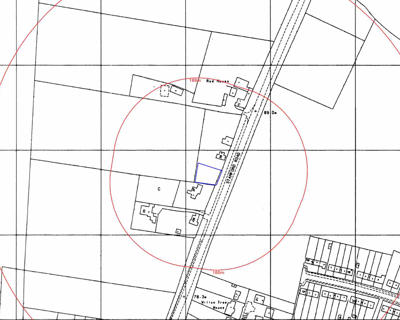 contamination may affect the site, this is undertaken by reviewing the site history using a combination of O.S. maps, aerial, plates and street level imagery, a review of data held by regulatory bodies (Environment Agency, local authority, BGS etc.) as well as a site walkover survey.
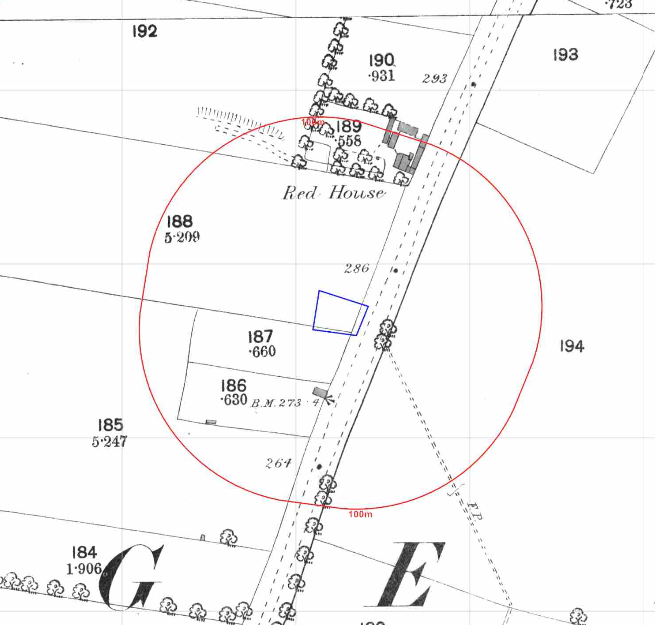
 The history of the site and surrounds were researched using a combination of Ordnance Survey (O.S.) maps, street level imagery and aerial plates, this revealed the site was undeveloped and by 1926 formed part of the curtilage of the adjoining dwelling.
Aerial plates indicated the site was separated circa 2004
Street level imagery of the site was obscured by bushes on the site boundaries.
The planning history of the site was reviewed as part of the desk based research and reports associated with any previous application were located and studied and whilst four previous applications were noted no salient information was sourced.
The published geological maps identified the site being in an area where no drift soils were recorded ot be present. The bedrock was given as the Lower Lincolnshire Limestone Member of the Bajocian Age.
 As part of the site visit three hand held trial puts were excavated, made ground was not recorded in the trial pits.
Data provided by the Coal Authority indicated that the site is not within a “Development High Risk Area”.
A review of the BGS borehole database did not reveal any borehole sin close proximity to the site.
Data provided by regulatory bodies did not provide any salient information. However a review of the risk form radon indicated the iste is in an area where full radon measures will be required.
The sensitivity of controlled waters was undertaken to determine if the site posed a risk to the nearby water bodies, this concluded that as the bedrock was a principal aquifer and was of moderate risk indicating the groundwater was a credible receptor.
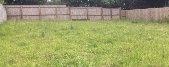
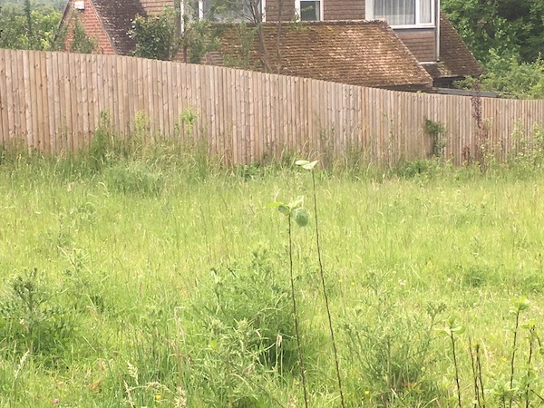
On completion of the desk based research a site reconnaissance visit was undertaken, this confirmed the site comprised of a parcel of open land.
Once the walkover survey was completed a qualitative risk assessment was undertaken on 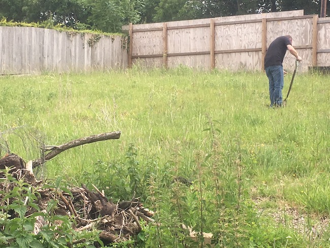 the potential sources of contamination identified in the desk study report in order to determine if any warranted further investigation, this concluded that the radon from the bedrock was a credible source of contamination.
The report concluded that the incorporation of full radon measures was required in order to break the pollution linkages identified in the desk study report.
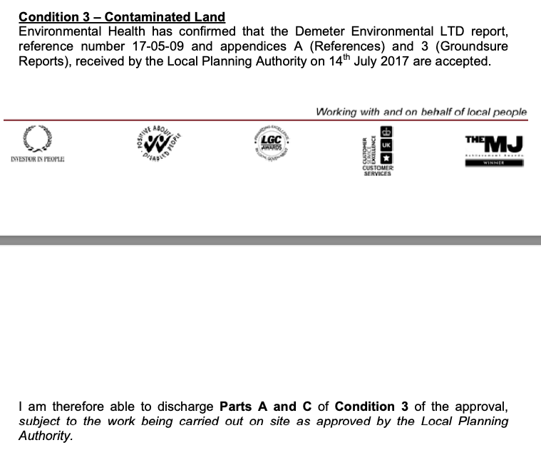
The Phase I and Phase II reports were submitted to partly discharge the contaminated land planning condition. The reports were accepted and the condition partly discharged.