Change Of Use From Agricultural Building To 2 Dwellings, Histon Road, Cottenham, CB24 8UG
Case Study Reference: CS15-12-01
Planning Authority: South Cambridgeshire District Council
Planning Reference: S/1668/15/PB and S/0451/18/DC
Synopsis:
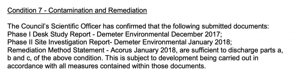
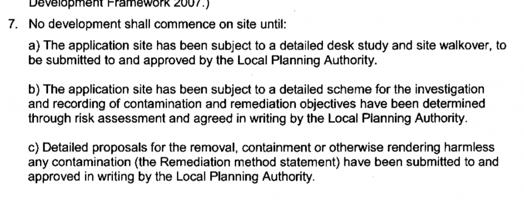
Given the sensitive nature of the development (residential) and the history of the site a contaminated land planning condition was attached to the decision notice for the proposed development.
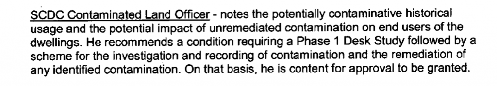
The first stage of discharging the condition was to prepare a Phase I desk study report in order to determine if the site has the potential to be impacted by elevated levels of contamination, and to determine the source as well as the likelihood of the risk occurring.
 A desk study determines what issues relating to historical contamination may affect the site, this is undertaken by reviewing the site history using a combination of O.S. maps, aerial, plates and street level imagery, a review of data held by regulatory bodies (Environment Agency, local authority, BGS etc.) as well as a site walkover survey.
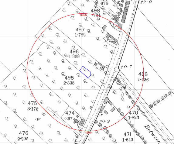
The history of the site and surrounds were researched using a combination of Ordnanc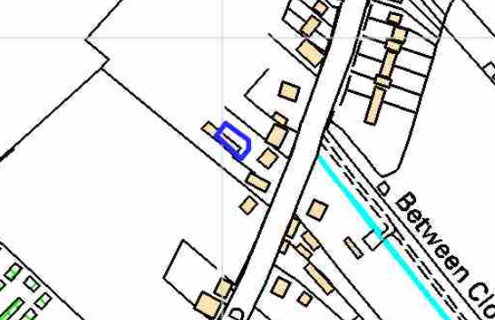 e Survey (O.S.) maps, street level imagery and aerial plates, this revealed the site had formed part fo an orchard which was cleared circa 1938 with the building identified by the 1994 map. Street level imagery was confined to images of the southern boundary of the site, which confirmed the building on site was agricultural.
The planning history of the site was reviewed as part of the desk based research and reports associated with any previous application were located and studied (two previous applications were noted), no salient information was obtained.
The published geological maps identified the site as being in an area where there were no drift soils recorded (i.e. bedrock was at the surface). The solid geology was given as the Woburn Sands Formation (sandstone) of the Albian / Aptian epoch.
 Data provided by regulatory bodies did not identify any potential sources of contamination.
The sensitivity of controlled waters were undertaken to determine if the site posed a risk to the nearby water bodies, this concluded that given as the bedrock was a principal aquifer the groundwater was of moderate risk and further assessment was warranted.
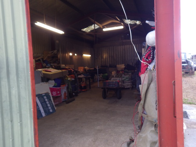
On completion of the desk based research a site reconnaissance visit was undertaken, this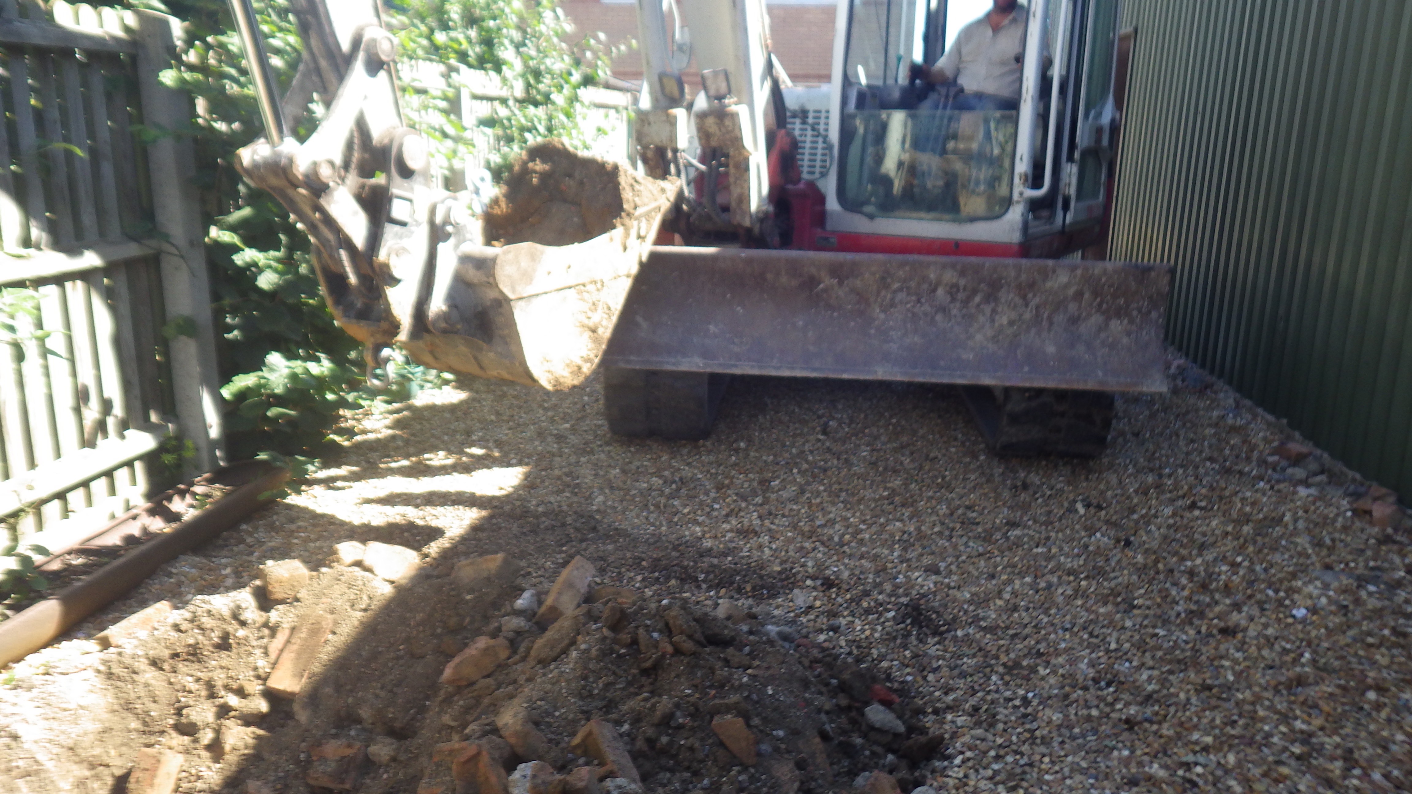 confirmed the site comprised of a barn, residential garage and gravelled external areas. The buildings were used for general household storage,
Once the walkover survey was completed a qualitative risk assessment was undertaken on the potential sources of contamination identified in the desk study report in order to determine if any warranted further investigation, this concluded that further works were required to fully assess the potential risks, the scope of works were given in the Phase I report.
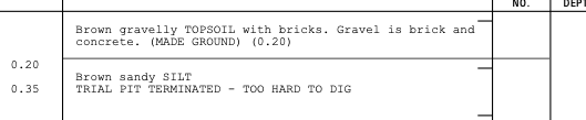 The further works were undertaken in January 2016 which comprised of the excavation of five trial pits to a depth of 1mbgl.
Samples of the site soils were taken and subject to chemical analysis, this data was assessed and concluded that the soils poses a risk to water mains and whilst concentrations of arsenic were elevated the absence of garden/landscaped areas broke any pollution linkages associated with arsenic.
Both the Phase I and Phase II reports were submitted to discharge the contaminated land planning condition (S/0451/18/DC), the reports were accepted and the condition discharged.