Erection of a Three Bedroomed Dwelling, Ross Road, Northampton
Case Study Reference: 15-11-02
Planning Authority: Northampton Borough Council
Planning Reference: N/2013/1144
Synopsis:
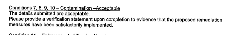
Due to the sensitive nature of the development and the site being located in an area of naturally occurring elevated levels of contamination a contaminated land planning condition was attached to the decision notice for the erection of a dwelling.

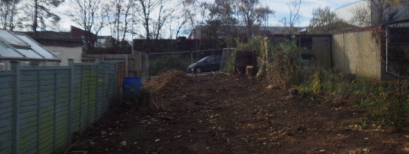
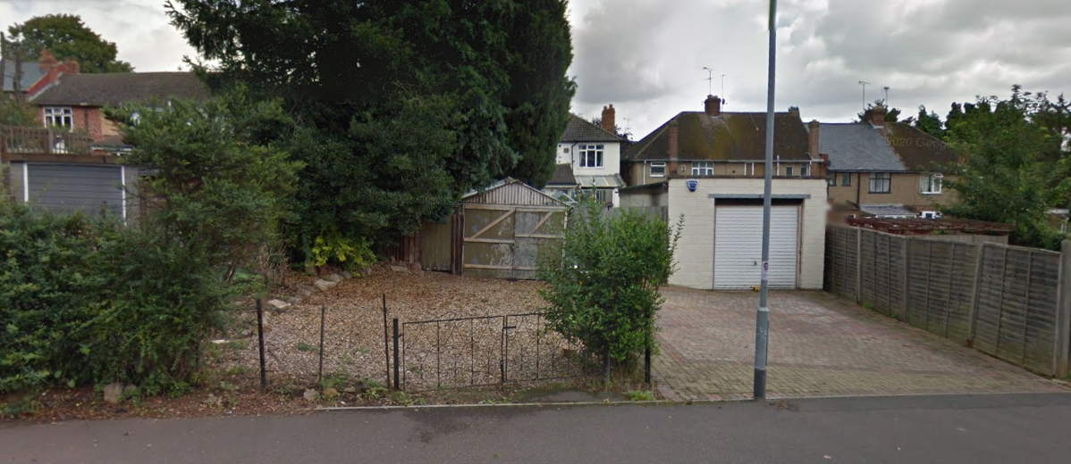 The first stage of discharging Condition 7 was to prepare a Phase I desk study report in order to determine the potential issues on the site. The desk study report reviews the site history using a variety of sources (historical Ordnance Survey maps, aerial plates street level imagery as well as information in the public domain) as well as information held by regulatory bodies (Environment Agency, BGS, local authority etc.). Photographs in the public domain indicated that the site was occupied by a residential garage
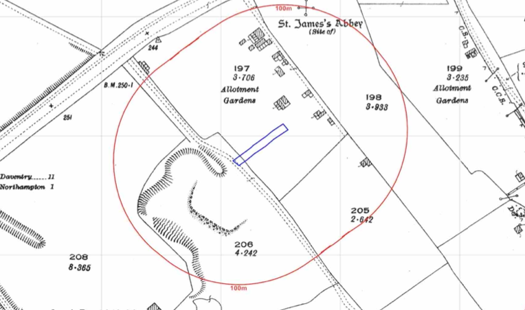 The historical maps revealed the site was adjoining a brick works from before the first edition O.S. map, by 1927 was no longer present and the site formed part of an allotment garden. By 1937 the site was identified as a dwelling.
The area of the former brick works was redeveloped circa 1962 and a number of industrial/commercial buildings were present.
The published geology (BGS) indicated that no drift soils were present on the site and the bedrock was the Northampton Sand Formation, which may be impacted by elevated concentrations of lead and arsenic.
Data provided by regulatory bodies identified three landfills from 150m to 250m from the site.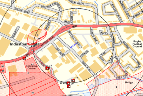
Data provided by Health Protection Agency indicated that the site was in an area where Full Radon measures would be required.
On completion of the desk based assessment a site walkover survey was undertaken, this confirmed that the site was a dwelling and associated garden.
As the potential for naturally elevated concentrations of contaminants were identified as well as the potential fgor contamination arising form the use of the site as allotment gardens as part fo the walkover survey samples of the natural soils were taken and subject to chemical analysis.
Whilst the initial analysis indicated that arsenic posed a potential risk, bipoaccessibility testing was undertake on order to undertake a Detailed Quantitative Risk Assessment which concluded that the risks on the site were negligible.
Whilst a number of potential sources of ground gas were present within 250m of the site, the risk was assessed and it was concluded that the full radon protection measures would be sufficient to break the pollution linkages associated with ground gases.
The report was accepted and the remedial measures proposed in the report will need to be incorporated into the building design.
As the Phase I report proposed remediation an Implementation Plan (Remediation Strategy) was required in order for the development to commence, this document provides detailed information on the remediation, how it will be achieved, justification to the gas/radon protection measures as well as the methodology of how the remediation will be validated. The Implementation Plan can also be accessed via the council planning portal.
The two reports were approved, with the validation of the remedial measures the only outstanding issue.