
Change of Use of Former Bus Depot, Dewsbury, Kirklees
Case Study Reference: 14-04-05
Planning Authority: Kirklees Council
Planning Reference: 2014/62/91625/E
Synopsis:
In order to demonstrate that after the development the site could not be classified as ‘contaminated land’ under Part 2A of the Environmental Protection Act a Phase I desk study report was required to support the application for the erection of a dwelling. The site was occupied by an agricultural building, the past use of the site have the potential to impact site soils.
 A Phase I desk study report assess the potential for a site to be impacted by contamination, this is undertaken by researching the history of the site and the surrounds as well as a review of information held by regulatory bodies and a site visit.
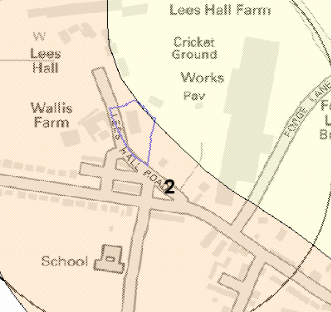
 The history of the site and surrounds were researched using a
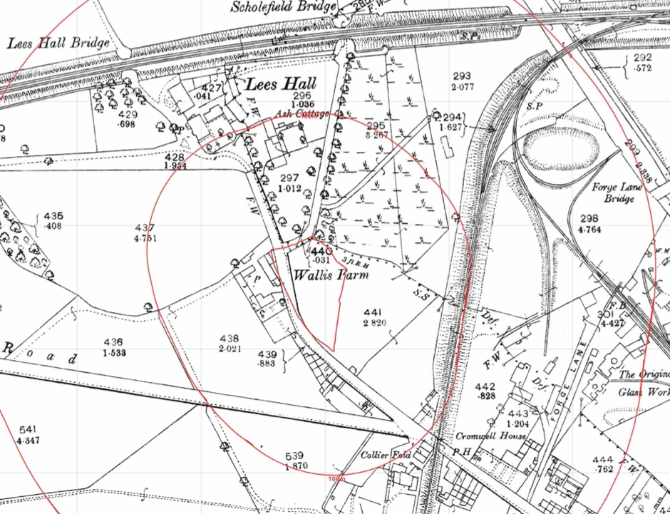
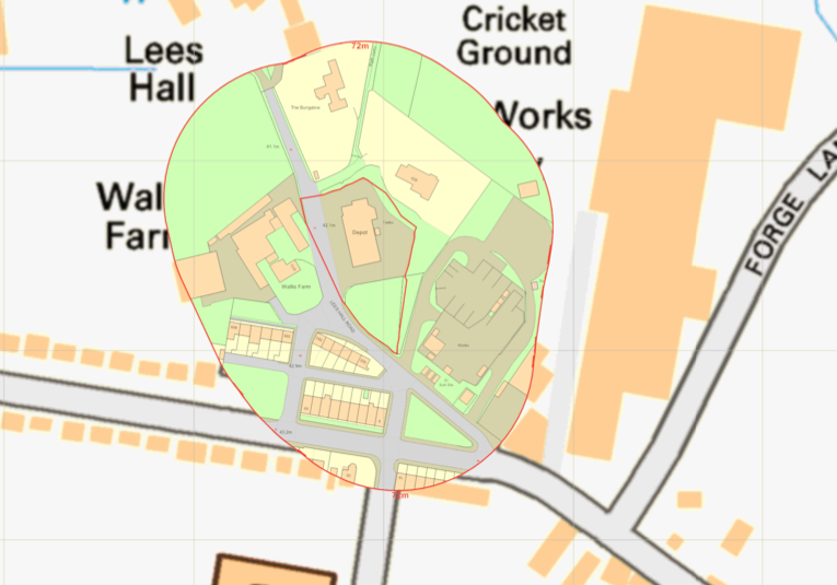 combination of Ordnance Survey (O.S.) maps, street level imagery and aerial plates, this revealed that the site was initially open land with an excavation noted on the site on the 1922 map. The 1965 map identified the site as being part of a landfill, by 1971 the site had been redeveloped ad was occupied by a depot.
A number of tanks were noted on the eastern boundary of the site on the 1989 map.
A number of potentially contaminative land uses were noted on close proximity to the site including railway lines, works and excavations.
The planning history of the site was reviewed as part of the desk based research, two previous applications were noted and the reports associated with these previous application were located and studied, no salient information was obtained.
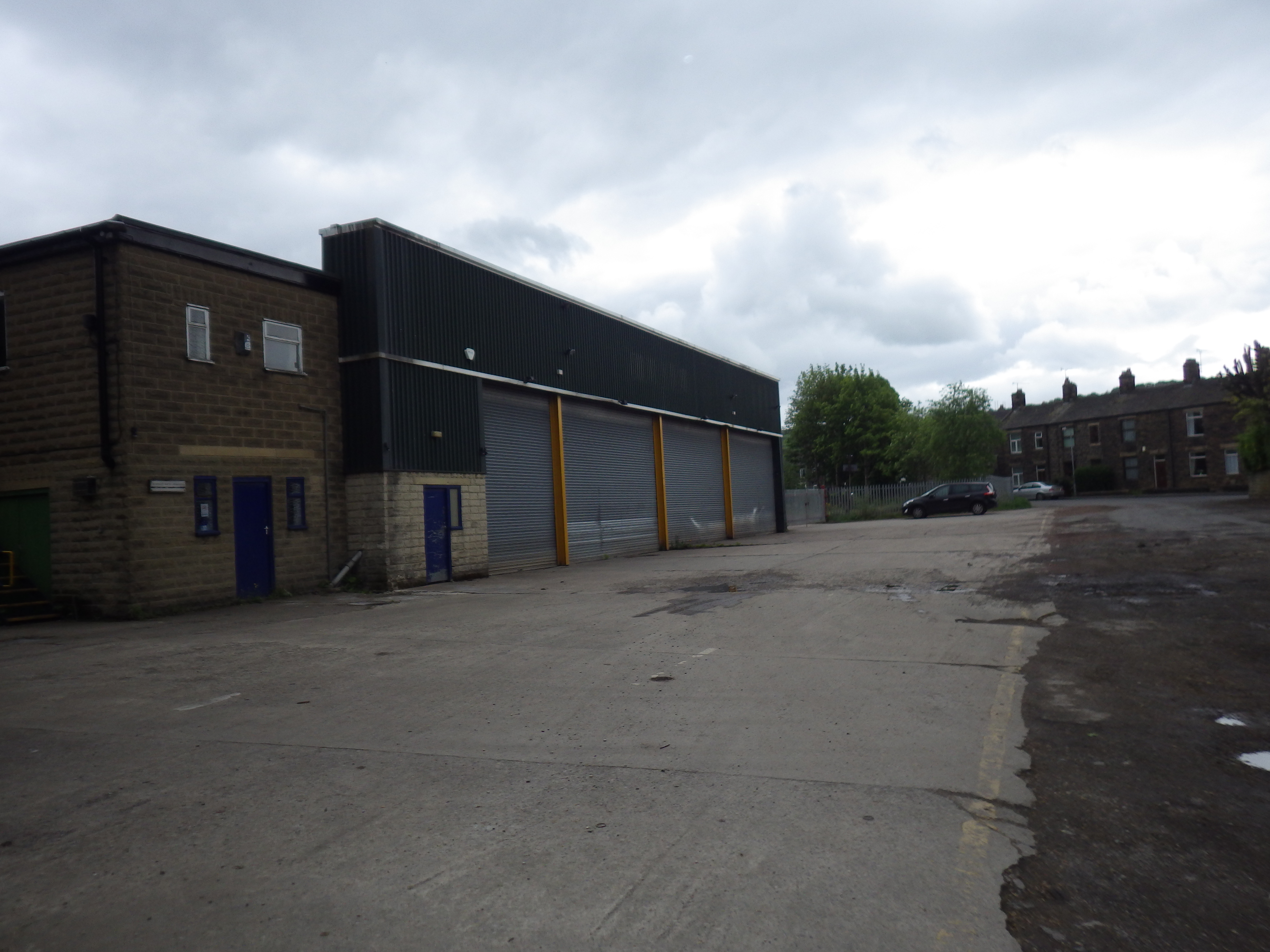
Street level imagery from October 2008 confirmed the site was occupied by a commercial unit which appeared to be vacant at the time of the image.
 The published geological maps identified the drift soils as alluvium (potential source of ground gases) at the north eastern boundary of the site with river terrace deposits across the reminder of the site. The bedrock was given as Penning Lower Coal Measures.
The Coal Authority were consulted and the site was not within a ‘Development High Risk’ area.
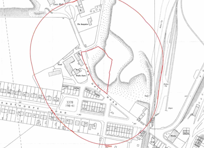
Data provided by regulatory bodies confirmed the presence of a number of heaps and a pit within 250m of the site, the data also confirmed the site was occupied by a vehicle repair works.
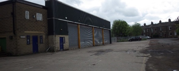
On completion of the desk based research a site reconnaissance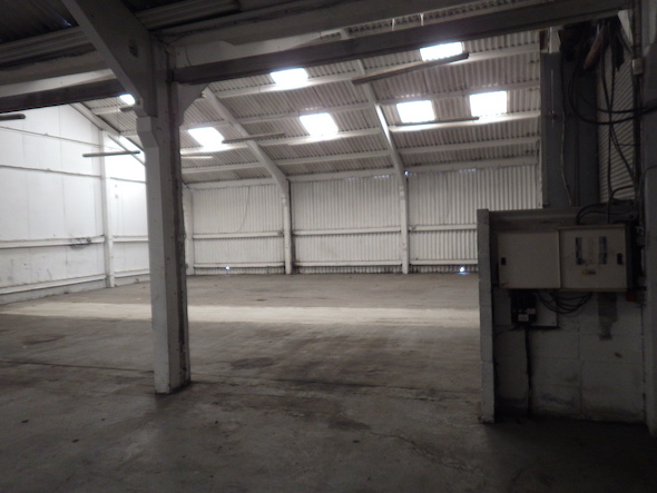 visit was undertaken, this confirmed the site was occupied by a commercial unit, with a two storey office area and an open area. A number of inspection pits were noted in the open area.
Once the walkover survey was completed a qualitative risk assessment was undertaken on the potential sources of contamination identified in the desk study report in order to determine if any warranted further investigation, this concluded that as the proposed developed was of low sensitivity (commercial) and there would be no landscaped areas as part fot he development the risks from the potential sources of contamination was low and the assessment concluded that no further assessment was warranted.
The report was submitted alongside the application and the recommendations of the report accepted.
