Erection of a Replacement Dwelling, St Georges Road, Rochdale, OL11
Case Study Reference: CS14-03-16
Planning Authority: Rochdale Metropolitan Borough Council
Planning Reference: 14/00059/FUL and 14/00495/DOC
Synopsis:
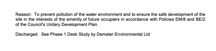
Given the sensitive nature of the development (residential) and the history of the site a contaminated land planning condition was attached to the decision notice for the proposed development.
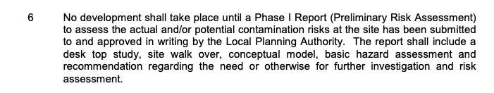
The first stage of discharging the condition was to prepare a Phase I desk study report in order to determine if the site has the potential to be impacted by elevated levels of contamination, and to determine the source as well as the likelihood of the risk occurring.
 A desk study determines what issues relating to historical contamination may affect the site, this is undertaken by reviewing the site history using a combination of O.S. maps, aerial, plates and street level imagery, a review of data held by regulatory bodies (Environment Agency, local authority, BGS etc.) as well as a site walkover survey.
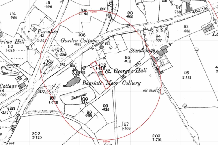
The history of the site and surrounds were researched using a combination of Ordnance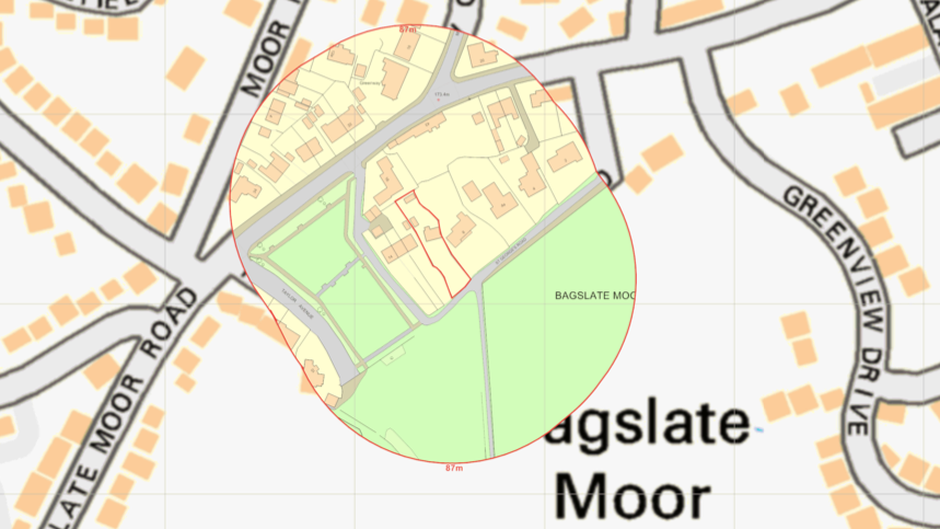 Survey (O.S.) maps, street level imagery and aerial plates, this revealed the site was developed circa 1890 labelled as ‘St Georges Hall’ was present. Later maps identifify the building as a dwelling, which was confirmed by street level imagery.
A number of potentially contaminative land uses were noted within 250m of the site including a sandstone querry, colliery and excavations.

The planning history of the site was reviewed as part of the desk based research and the reports associated with any previous applications were located and studied, no salient information was obtained
 The published geological maps identified the site as being underlain by Devensian TIll which in turn was underlain by the Pennine Lower Coal Measures. As no publicly available boreholes for the areas were available from the BGS no further information on ground conditions could be obtained.
Data provided by regulatory bodies confirmed the presence of a number of ground workings, quarry and a colliery within 250m of the site.
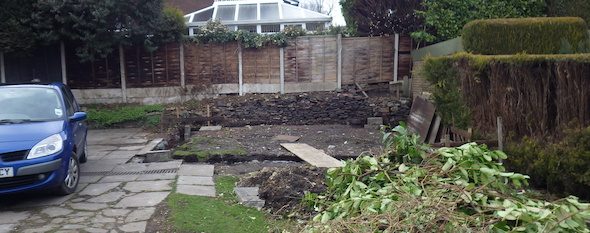
On completion of the desk based research a site reconnaissance visit was undertaken, this confirmed the site was occupied by a two storey dwelling and associated garden areas,
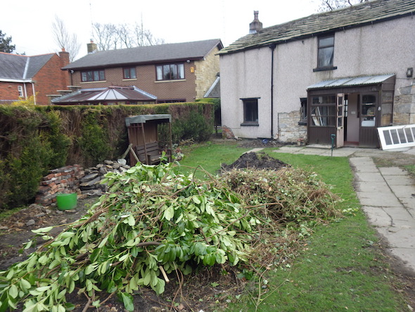 As part of the walkover survey the ground conditions were noted,
  made ground was identified in the area of the former garage although no evidence of made ground was noted in the tranches on the garden areas.
Once the walkover survey was completed a qualitative risk assessment was undertaken on the potential sources of contamination identified in the desk study report in order to determine if any warranted further investigation, this concluded that the in-filled land within 250m of the site poses a potential risk to the site, given the low risk posed by ground gases the rpeort concluded that the incorporation of gas protection measures in lieu of ground gas monitoring was suitable for the proposed development.
The report was submitted to partially discharge the contaminated land planning condition (14/00495/DOC) the recommendations were accepted and the condition partly discgharged.