
Erection of a Detached Dwelling, Kingsley Road, Northampton, Northamptonshire, NN2
Case Study Reference: 13-04-04
Planning Authority: Northampton Borough Council
Planning Reference: N/2010/0552
Synopsis:
Due to the sensitive nature of the development and the site being in an area of naturally elevated levels of contamination a contaminated land planning condition was attached to the decision notice for the proposed development.
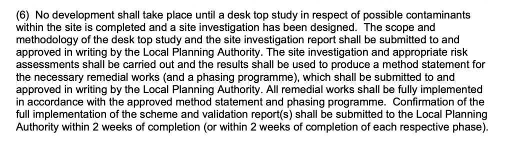
In order to commence with the discharge of the condition a Phase I Desk Study report was required. A Phase I desk study report assess the potential for a site to be impacted by contamination, this is undertaken by researching the history of the site and the surrounds as well as a review of information held by regulatory bodies and a site visit.
The first stage of the preparation of the desk study report was to assess the information held on the site by regulatory bodies (Environment Agency, Ordnance Survey, British Geological Survey, Local Authority etc.) as well as the history of the site and the surrounds.
 The history of the site and surrounds were researched using a combination of Ordnance Su
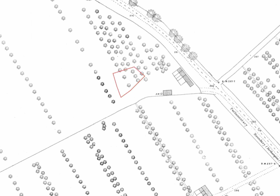
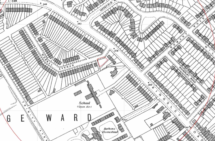 rvey (O.S.) maps, street level imagery and aerial plates, the review indicated the site formed part of an orchard to around 1938 when the area was developed into a residential estate.
A quarry was identified to the south east of the site on the 1884 map which was initially developed circa 1926.
A review of the planning history of the site did not reveal any salient information.
The published geology was reviewed using published geological maps, this revealed that till was present on the site with the Northampton Sand Formation under the till. The soils have the potential to be impacted by naturally occurring metal contamination.
As the site is in an area that is affected by radon, data from the Health Protection Agency/BRE was obtained, this confirmed the site was in an area where full radon measures were required.
Data provided by regulators identified cuttings and workings to the west of the site and confirmed the quarry identified on the O.S. maps was ‘Bass’s sand pit’.
 On completion of the desk based research a site reconnaissance
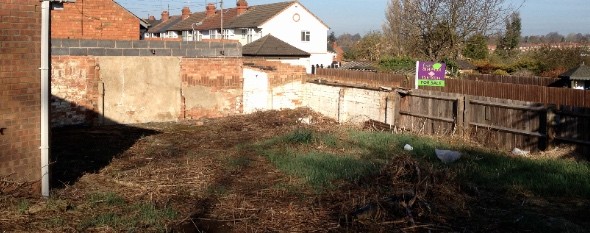
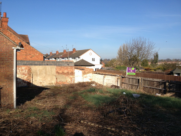
 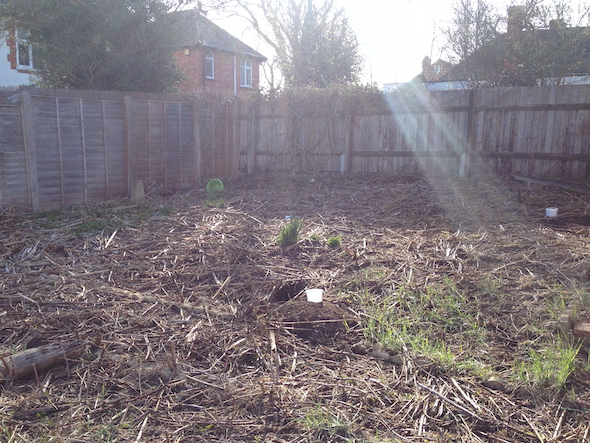 visit was undertaken, this revealed that the site formed part of the garden of the adjacent dwelling, hand held boreholes were sunk on the site to investigate for the presence of made ground and to obtain samples for arsenic analysis.
Once the walkover survey had been completed the qualitative risk assessment was undertaken in order to assess the potential risks of the potential sources of contamination identified in the report. This concluded that the arsenic in the natural soils, radon from the bedrock required further assessment. For at the arsenic this entailed undertaking bioaccessibility testing and for radon, the incorporation of full radon measures in to the building.
Bioaccessibility testing was undertaken on the samples taken at the time of the site walkover survey, the assessment was submitted under separate cover and this demonstrated that the arsenic in the natural soils did not pose a risk to human health.
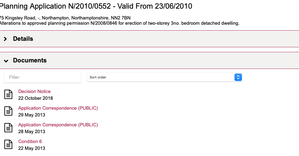
The Phase I report (Condition6) was submitted to discharge the contaminated land planning condition with the ‘Application Correspondence’ of the 28th May 2013 confirming the report was accepted.
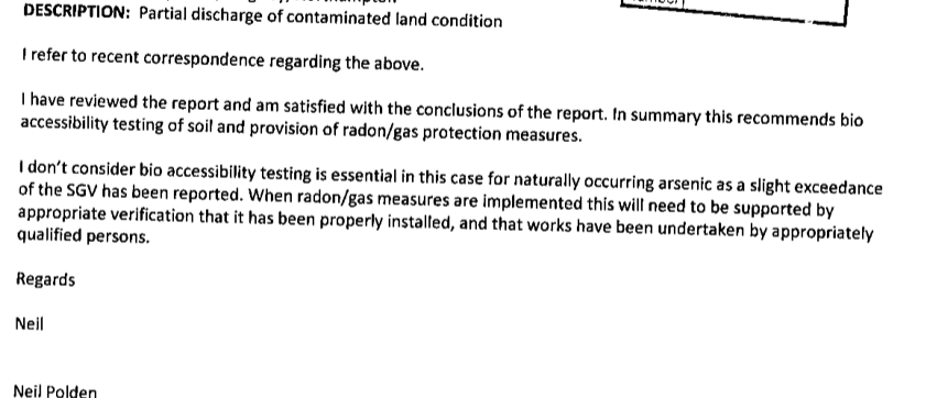
The proposals for radon/gas protection measures were accepted and the condition partly discharged.