Residential Development, High Road, Guyhirn, Cambridgeshire
Case Study Reference: 15-12-06
Planning Authority: Fenland District Council
Planning Reference: F/YR15/0667/F and F/YR11/0478/F
Synopsis:
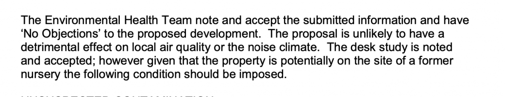
Due to the past uses of the site and the sensitivity fo the proposed development (residential) nature of the site a contaminated land planning condition was attached to the decision notice which required that potential sources of contamination need to be investigated before the development commences.
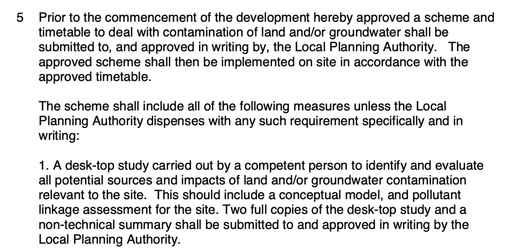
The first stage of discharging the condition was to prepare a Phase I desk study report in order to determine if the site has the potential to be impacted by elevated levels of contamination, and to determine the source as well as the likelihood of the risk occurring.
 A desk study determines what issues relating to historical
contamination may affect the site, this is undertaken by reviewing the site history using a combination of O.S. maps, aerial, plates and street level imagery, a review of data held by regulatory bodies (Environment Agency, local authority, BGS etc.) as well as a site walkover survey.
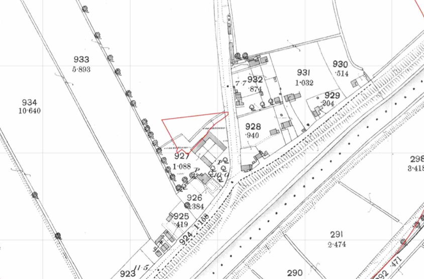
The history of the site and surrounds were researched using a combination of Ordnance 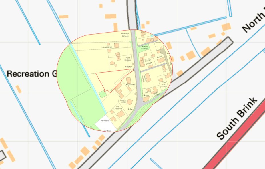 Survey (O.S.) maps, street level imagery and aerial plates, this revealed the site was initially open land on the 1886 map, the 1927 map identified part of the site as forming part off an orchard., the 1977 map shows an access track on the site.
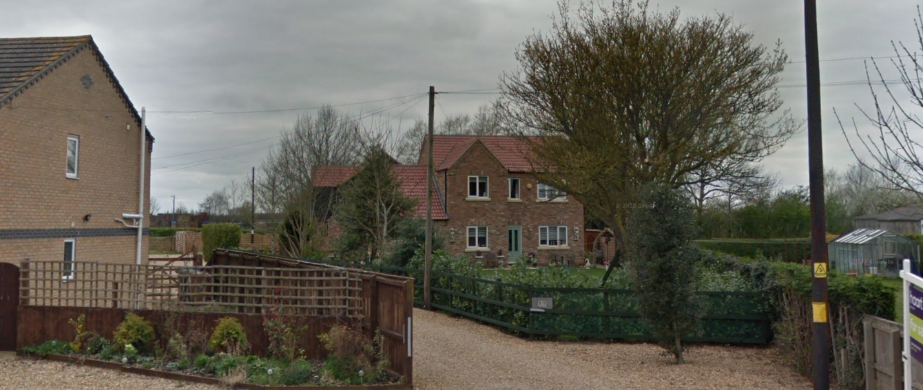
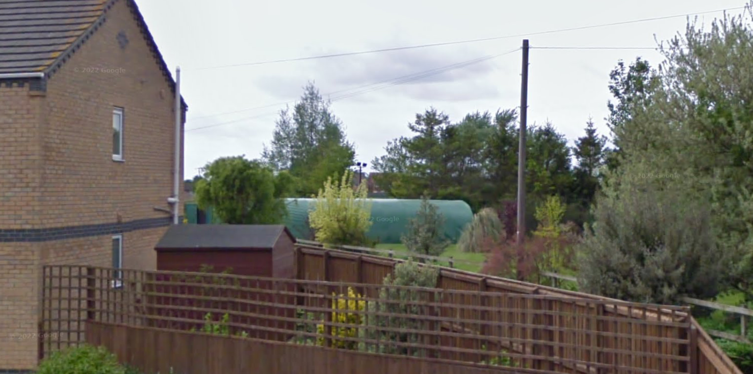
Aerial plates identified a polytunnel on the site, this was confirmed with street level imagery.
The planning history of the site was reviewed, no salient information was obtained.
The published geological maps identified the site as being underlain by Tidal Flat deposits and the Ampthill Clay Formation.
A previous site investigation report was provided by the client, the investigation comprised of the excavation of four trial pits excavated, no evidence of made ground was recorded in any locations, the recorded geology confirmed the documented geology. A thin layer of peat weas recorded on the eastern area of the site.
Data provided by regulatory bodies did not identify any potential sources of contamination.
 On completion of the desk based research a site reconnaissance
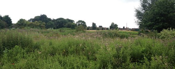
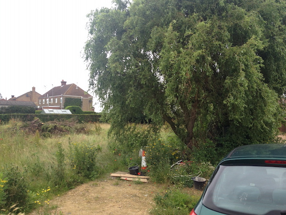
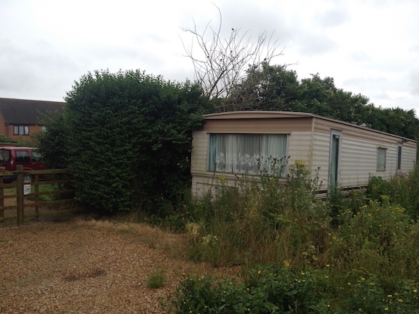 visit was undertaken, this revealed the site comprised of an open overgrown parcel of land which limited the access.
Once the walkover survey was completed a qualitative risk assessment was undertaken on the potential sources of contamination identified in the desk study report in order to determine if any warranted further investigation, this concluded that there were no credible sources of contamination on the site and no further works were proposed.
The report was updated in December 2015 in light of a new application which was submitted to support the new application (F/YR15/0667/F).