Change Of Use Of Agricultural Buildings To B8 Storage, Astrop Park, Kings Sutton, OX17
Case Study Reference: CS22-12-03
Planning Authority: South Northamptonshire Council
Planning Reference: WNS/2022/0100/FUL and WNS/2023/0365/COND
Synopsis:
Given the history of the site (farm), a contaminated land planning condition was attached to the decision notice for the proposed development.
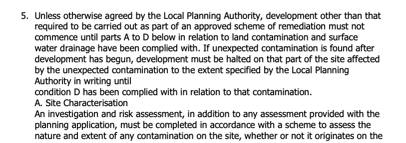
The first stage of discharging the condition was to prepare a Phase I desk study report in order to determine if the site has the potential to be impacted by elevated levels of contamination, and to determine the source as well as the likelihood of the risk occurring.
 A desk study determines what issues relating to historical contamination may affect the site, this is undertaken by reviewing the site history using a combination of O.S. maps, aerial, plates and street level imagery, a review of data held by regulatory bodies (Environment Agency, local authority, BGS etc.) as well as a site walkover survey.
The history of the site and surrounds were researched using a combination of Ordnance 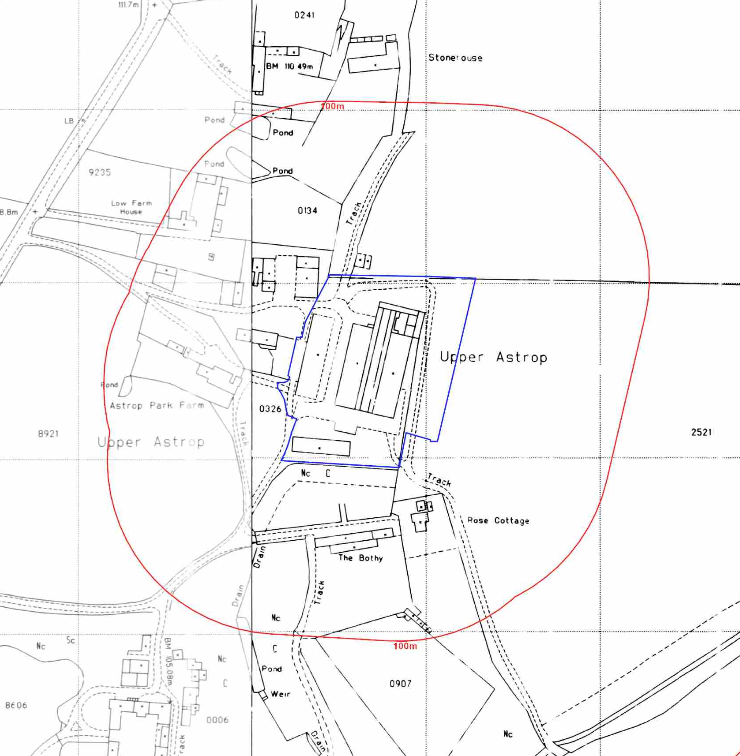 Survey (O.S.) maps, street level imagery and aerial plates, this revealed that the site had initially formed part of a larger parcel of open land with a building (likely agricultural) crossing the western boundary. The site was developed between 1966 and 1981 when four buildings, likely agricultural were identified on the site. The 1979 map identified the site as forming part of a farm The 1999 aerial plate identifies a fourth large building on the eastern boundary.
The planning history of the site was reviewed, whilst four previous applications were noted and the associated documents were reviewed, these revealed the site was developed around 1977 with extensions circa 1995. A planning statement also indicated the site was part of a dairy farm.
The published geological maps for the area indicated that no drift soils were recorded to be present on the site with the bedrock – the Marlstone Rock Formation (ferruginous limestone and ironstone) being exposed at the surface.
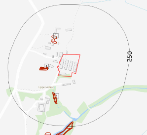 Data provided by regulatory bodies confirmed the presence of a number of ponds within 250m of the site. A tank was identified to be present on site as well as a gas works to the south.
In order to determine if the risks to controlled waters required further assessment the sensitivity of both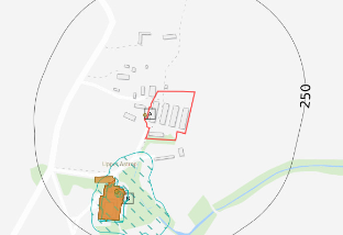 nearby surface water courses and the groundwater in the bedrock was assessed, it was concluded that both were of low sensitivity and no further assessment was warranted,
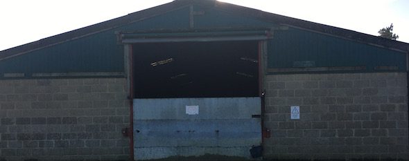
 On completion of the desk based research a site reconnaissance visit was undertaken, this identified the site was occupied by five agricultural buildings which included a disused poultry shed.
 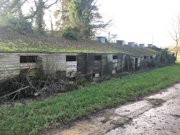 Damaged cement sheeting was noted in the area of the poultry shed.
Once walkover survey was completed a qualitative risk assessment was undertaken on the potential sources of contamination identified in the desk study report in order to determine if any warranted further investigation, this concluded that the made ground, damaged cement sheeting posed a risk to the proposed development.
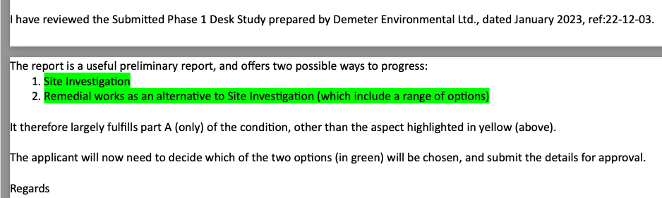
Given the low sensitivity of the proposed development (commercial with minimal landscaping) proposals for further intrusive works or remediation in lieu of intrusive works were given.
The report was submitted (WNS/2023/0365/COND) to discharge the first part of the contaminated land planning condition. The proposals were accepted and confirmation of the preferred way forwards by the client was required.