Erection Of A Steel Frame Building, Henry Lee Street Bolton BL3
Case Study Reference: CS22-10-07
Planning Authority: Bolton Metropolitan Borough Council
Planning Reference: https://www.bolton.gov.uk/planning-applications-guidance/planning-7/5 and https://paplanning.bolton.gov.uk/online-applications/applicationDetails.do?previousCaseType=Property&keyVal=ZZZPCWDEPM555&previousCaseNumber=QTCPJS00DT03M&previousCaseUprn=200002562321&activeTab=summary&previousKeyVal=QTCPJS00DT03O
Synopsis:
As the proposed development site was in an area where coal mining legacies may impact on ground stability a Coal Mining Risk Assessment was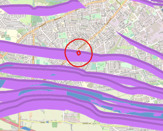 required to support the application for the erection of a dwelling.
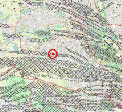
As part of the assessment a Coal Authority report was procured which indicated that the site was in an area where coal may be close or at the surface, this was confirmed by the review of the large scale geological maps as well as the Coal Authority plans for the area.
The published geology indicated that Devensian Till was underlain by the Pennine Lower Coal Measures Formation of the Langsettian epoch.
No BGS boreholes were in close proximity to the site.
Data provided by the Coal Authority indicated the site was in a ‘Development High Risk Zone’ relating to probable shallow worked seams.
Data provided by the Coal Authority in their Consultants Report indicated that a coal seam outcropped to the north of the site.
Given the sensitive nature of the development (residential) and the history of the site a contaminated land planning condition was attached to the decision notice for the proposed development.
The first stage of discharging the condition was to prepare a Phase I desk study report in order to determine if the site has the potential to be impacted by elevated levels of contamination, and to determine the source as well as the likelihood of the risk occurring.
 A desk study determines what issues relating to historical contamination may affect the site, this is undertaken by reviewing the site history using a combination of O.S. maps, aerial, plates and street level imagery, a review of data held by regulatory bodies (Environment Agency, local authority, BGS etc.) as well as a site walkover survey.
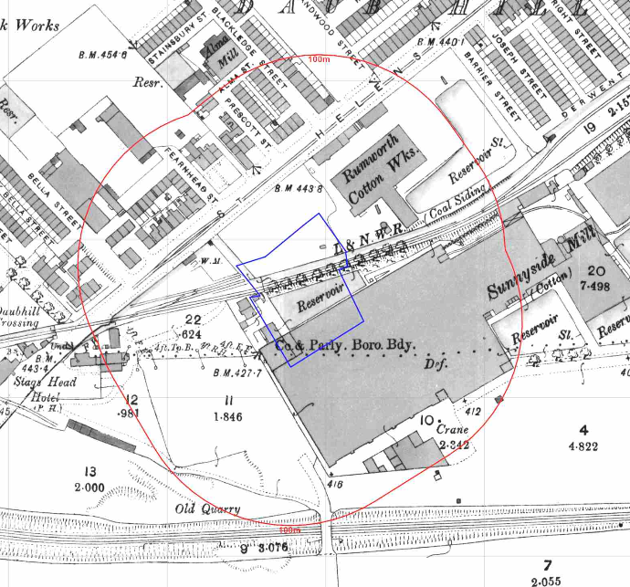
The history of the site and surrounds were researc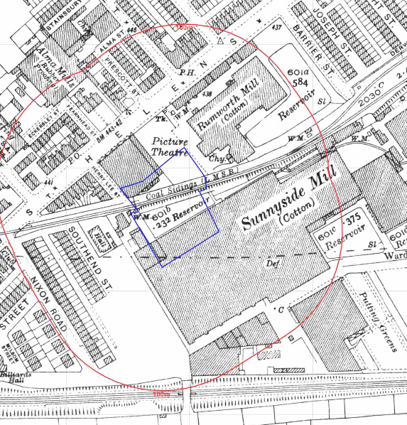 hed using a combination of Ordnance Survey (O.S.) maps, street level imagery and aerial plates, this revealed the site was developed prior to the 1849 map when a railway line crossed the site, the 1891 map identifies a mill and a reservoir on the site.
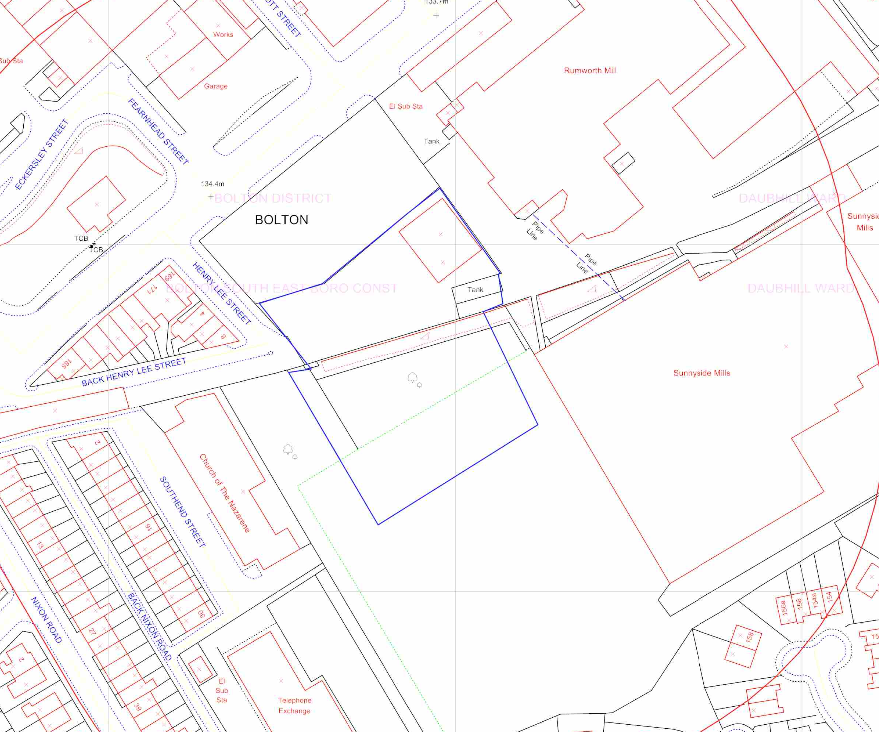 The 1927 map identifies a picture theatre on the northern area of the site and by 1977 the railway line has been dismantled. A tank was also noted on the 1990 map with the aerial plates indicating vehicles were stored on site.
A number of potentially contaminative land uses were identified adjoining the site as well as a number of parcels of in-filled land within 250m.
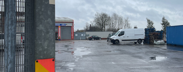
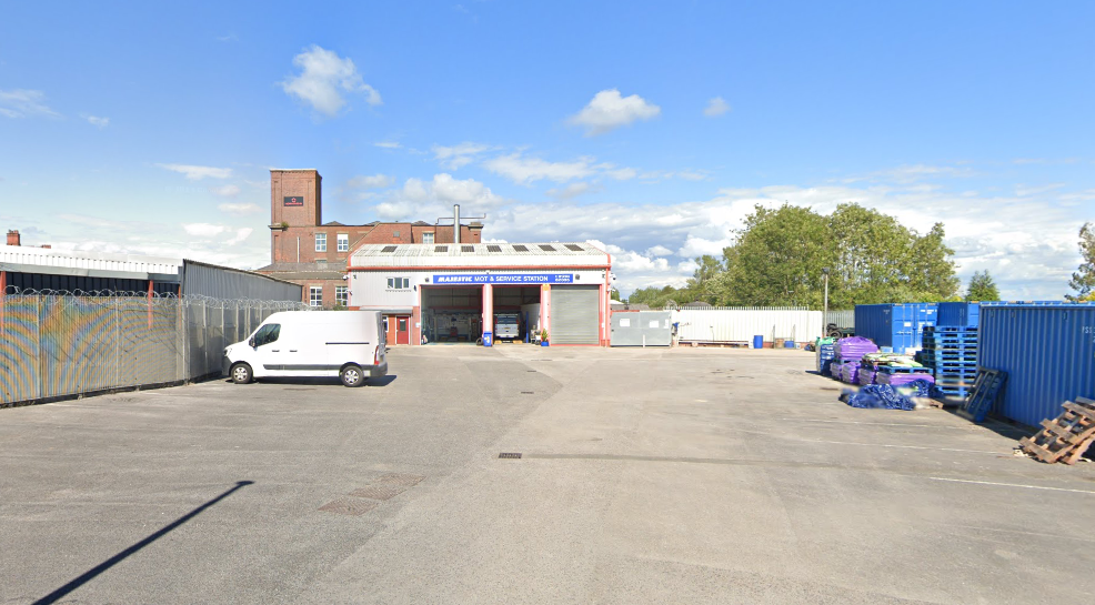
Street level imagery of the site confirmed the site was commercial with the building being used as a garage.
The planning history of the site was reviewed as part of the desk based research and reports associated with any previous application were located and studied, no salient information was sourced.
The published geology indicated that Devensian Till was underlain by the Pennine Lower Coal Measures Formation of the Langsettian epoch.
A review of the BGS borehole database did not reveal any borehole sin close proximity to the site.
Data provided by regulatory bodies identified two quarries as well as a number of parcels of potentially in-filled land as well as two landfills and a number of potentially contaminative land uses.
The sensitivity of controlled waters was undertaken to determine if the site posed a risk to the nearby water bodies, this concluded that the groundwater was a not credible receptor.
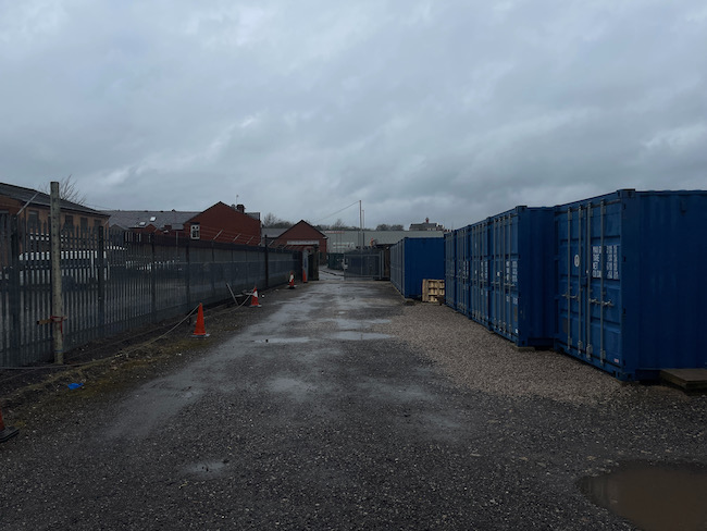
On completion of the desk based research a site reconnaissance visit was undertaken, this confirmed t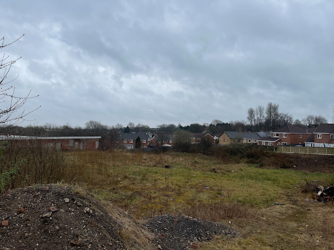 he site comprised of a a garage, associated areas of hard-standing with a tank adjacent to the garage.
Once the walkover survey was completed a qualitative risk assessment was undertaken on the potential sources of contamination identified in the desk study report in order to determine if any warranted further investigation, this concluded that given the low sensitivity of the development the incorporation of gas/vapour protection measures was a suitable alternative to further works.
In order to further assess the risk from worked seams the coal mining investigation comprising of the sinking of rotary boreholes to 30mbgl was undertaken in June 2023.
A single borehole was sunk and as there was no evidence of coal a further two boreholes were not required and the risk from worked seams was discounted as a potential issue.
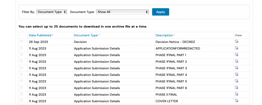
Both the Phase I and Coal Mining Investigation report were submitted to discharge the applicable conditions (16596/23), the recommendations of both report were accepted and the condition discharged.