Residential Development, Lancaster New Road, Cabus, Preston, Lancashire, PR3
Case Study Reference: CS21-09-04
Planning Authority: Wyre Council
Planning Reference: 18/00757/FUL and 18/00757/DIS
Synopsis:
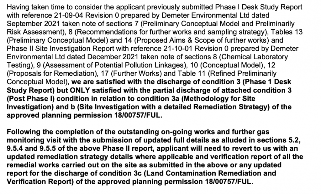
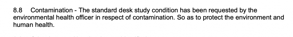 Given the sensitivity of the proposed development and that insufficient information to assess the potential contamination risks on the site were submitted with the application a contaminated land planning condition was attached to the decision notice for the residential redevelopment of the site.
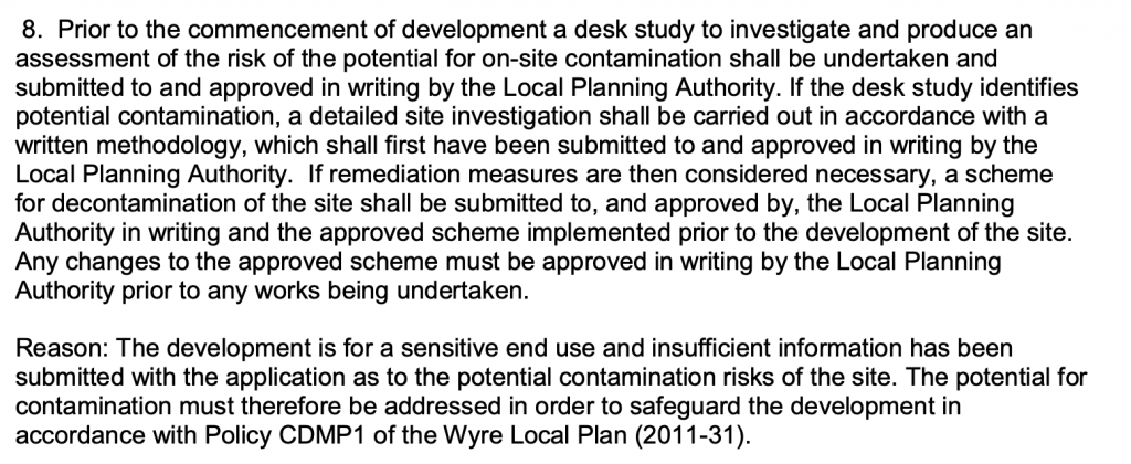
The first requirement of the condition was to have a Phase I desk study report submitted and approved by the local authority before any further works were undertaken. A desk study report assesses the potential for a site to be impacted by elevated levels fo contamination in site soils. The assessment is based on a review of the history of the site (using various sources such as Ordnance Survey maps, aerial pates, street level imagery etc.), data provided by regulatory bodies (Coal, Authority, Environment Agency, BGS, local authority etc.) as well as a site reconnaissance visit.
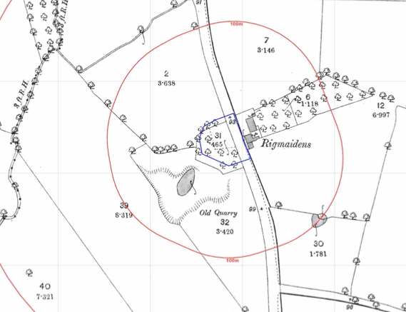 The review of the O.S. maps revealed the site
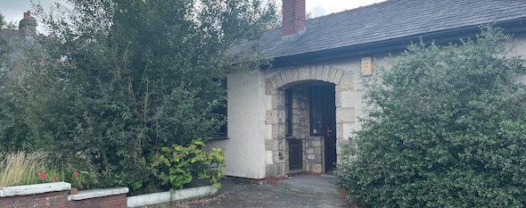
 was developed circa 1932 when the building on the southern area of the site was noted, the remainder of the site was developed prior to 1961. Street level imagery confirmed the southern building was a dwelling.
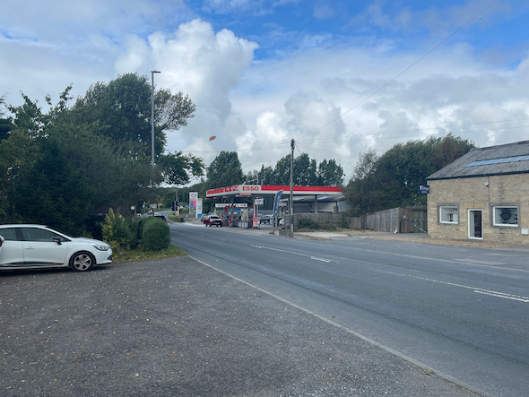
A garage and works were identified on the opposite side of Lancaster New Road as well as a quarry on the south western boundary and a nursery 30m east. A railway cutting was also noted 230m east of the site.
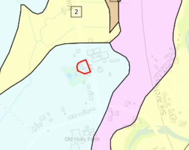 The published geology identified deposits of alluvium in close proximity to the site.
Data provided by regulators identified the quarry on the south western boundary as being ‘Rigmaidens Quarry’ the adjoining garage and works as well as the railway cutting 220m east of the site.
 On completi
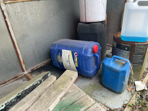
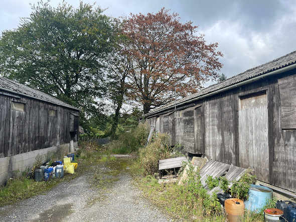 on of the desk based research a site reconnaissance visit was undertaken, this revealed the site to comprise of a dwelling and associated gardens as well as a number of outhouses on the northern area which appeared to be poultry sheds. Chemical containers were noted in a number of locations across the northern area.
The former quarry was inspected form the site boundary was it was not clear if there had been any in-filling.
On completion of the site visit a qualitative risk assessment was undertaken on the potential sources of contamination identified in order to determine if any warranted further works.
It was determined that the made ground on the site as well as the chemical storage, the alluvium and the adjoining land uses have the potential to impact on site soils.
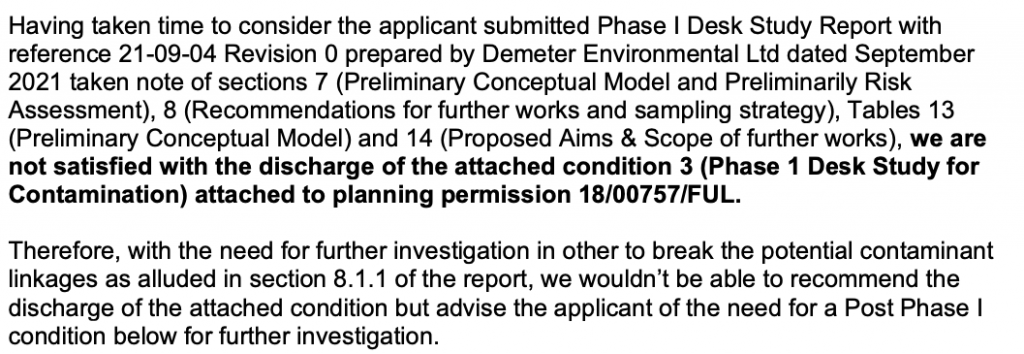
Due to time constrains the Phase II investigation was undertaken prior to the approval of the Phase I report. The Phase I report was submitted with 18/00757/DIS and the proposals were approved.
The Phase II site investigation was undertaken in October 2022 and comprised of the excavation of trial pits as well as the sinking of dynamic sampling boreholes in order to install ground gas monitoring wells.
Samples of the made ground and natural soils were taken and a number were subject to chemical analysis, the assessment of this data concluded that the made ground on the site posed a risk to human health. Potential issues relating to the natural soils on the southern area were also identified.
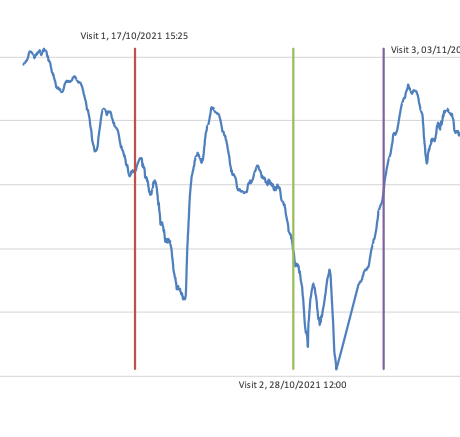 On completion of the ground gas monitoring it was concluded that whilst monitoring during a reasonable worst case scenario was not able to be undertaken, the results were sufficiently low the assessment concluded that the site was not impacted by ground gases.
The recommendations of the report were accepted.