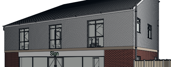
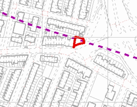
Erection of a Mixed Use Building, Burnley Lane, Chadderton, Oldham, OL1
Case Study Reference: CS21-05-07
Planning Authority: Oldham Metropolitan Borough Council
Planning Reference: Oldham Metropolitan Borough Council and FUL/346634/21
Synopsis:
Due to the site being within a ‘Development High Risk Area’ the Coal Authority raised an object to the application until the applicant had submitted a Coal Mining Risk Assessment (CMRA).
The aim of a CMRA is to identify any coal mining legacy risks and set out a proposed mitigation strategy to demonstrate to the LPA that the site can be made safe and stable for the proposed development. In some cases it may be possible to ensure that the development layout avoids recorded high risk features.
The published geology indicated that the site was underlain by Devensian Till which in turn was underlain by the Pennine Lower Coal Measures formation. There were no boreholes published by the BSG in close proximity fo the site however the closest boreholes indicate the bedrock was at approximately 12mbgl.
 An inferred coal seam was recorded to outcrop under the northern aea of the site and the dip in the general area was to the south west, indicating the seam will be present under the site.
Information provided by the Coal Authority also indicated that there was evidence to suggest that there was the possibility of unrecorded shallow worked seams (within 30m of the surface).
Based on the potential for ground instability further works were proposed, which would be required only once planning has been granted. Whilst ideally three boreholes are required given the size of the site initially a single borehole was proposed with the option for a further two if coal was encountered.
The Coal Authority raised their objection to the application and the requirement for the further works were conditioned.