Erection of a Dwelling, Chew Valley Road, Greenfield, OL3
Case Study Reference: CS21-05-02
Planning Authority: Oldham Metropolitan Borough Council
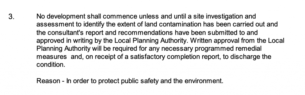
Planning Reference: PA/340010/17 and CND/347879/21
Synopsis:
Given the sensitive nature of the development (residential) a contaminated land planning condition was attached to the decision notice for the proposed development.
The first stage of discharging the condition was to prepare a Phase I desk study report in order to determine if the site has the potential to be impacted by elevated levels of contamination, and to determine the source as well as the likelihood of the risk occurring.
 A desk study determines what issues relating to historical contamination may affect the site, this is undertaken by reviewing the site history using a combination of O.S. maps, aerial, plates and street level imagery, a review of data held by regulatory bodies (Environment Agency, local authority, BGS etc.) as well as a site walkover survey.
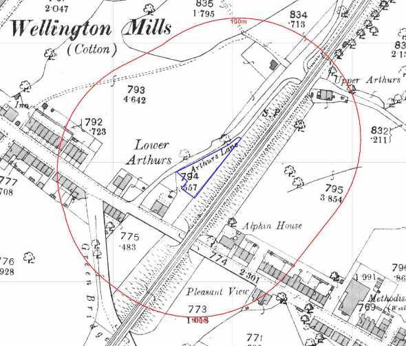
The history of the site and surrounds were researched using a combination of Ordnance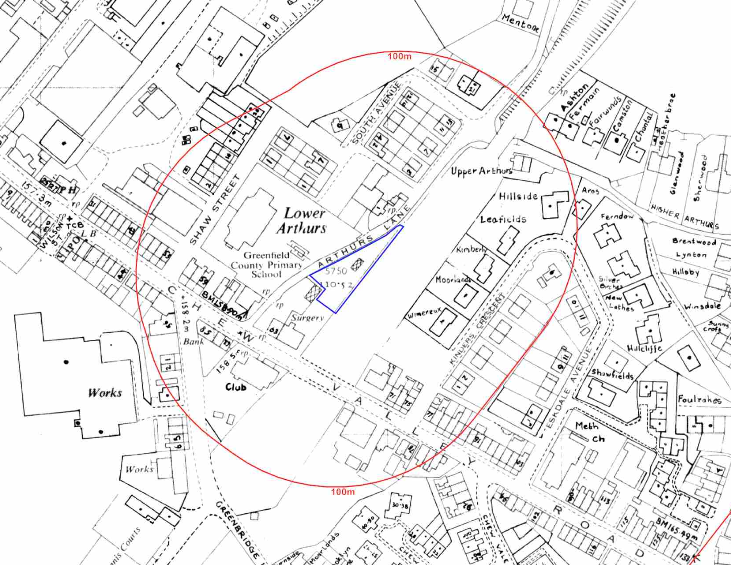 Survey (O.S.) maps, street level imagery and aerial plates, this revealed the site was initially (1854) open land and by 1890 formed part of the curtilage of the dwelling to the south west.
The 1952 map identified a glass house on the site. A railway line was noted on the eastern boundary which was lifted circa 1970.
A works was noted on the 1991 map 25m west of the site, street level imagery confirmed the building was used as an engineering works.
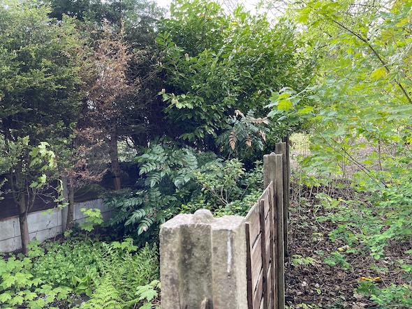
Street level imagery of the site was obscured by bushes on the site boundaries.
The planning history of the site was reviewed as part of the desk based research and reports associated with any previous application were located and studied and whilst a number previous applications were noted no salient information was sourced.
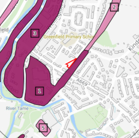 The published geological maps identified the site being in an area where no drift soils were recorded to be Devensian Till. The bedrock was given as hale Grit (sandstone) of the Namurian epoch. Whilst the large scale maps identified deposits of made ground on the south eastern boundary the 1:50,000 scale maps did not record this deposit.
Data provided by the Coal Authority indicated that the site is not within a “Development High Risk Area”.
A review of the BGS borehole database did not reveal any boreholes in close proximity to the site.
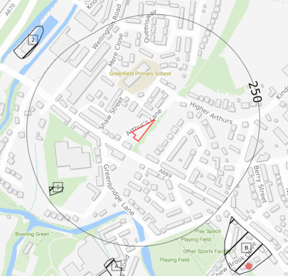 Data provided by regulatory bodies confirmed the presence of a sewage works to the west of the site as well as a number of cutt
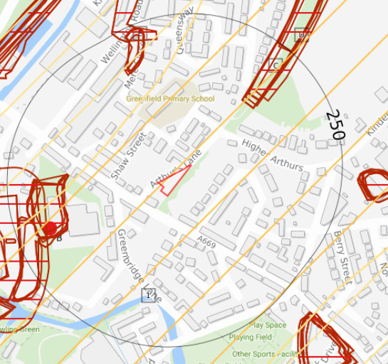 ings sand workings within 250m. Information regarding a landfill 200m south west of the site was also provided.
The sensitivity of controlled waters was undertaken to determine if the site posed a risk to the nearby water bodies, this concluded that as the bedrock was of low risk indicating the groundwater was not a credible receptor.
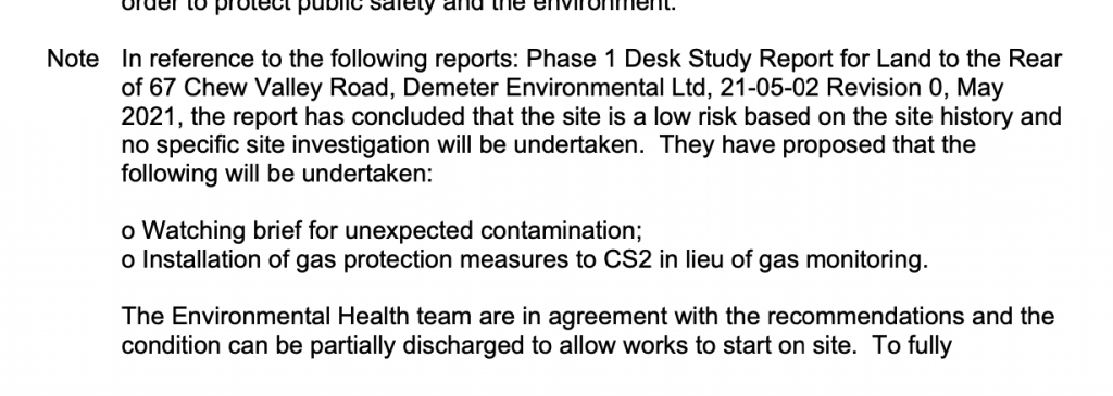
 On completion of the desk based research a site reco
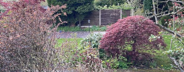
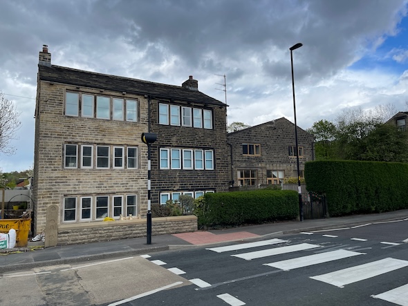 nnaissance visit was undertaken, this confirmed the site comprised of a garden.
Once the walkover survey was completed a qualitative risk assessment was undertaken on the potential sources of contamination identified in the desk study report in order to determine if any warranted further investigation, this concluded that the gassing risk from the deposits of made ground identified on the geological maps, the landfill and other parcels of in-filled land posed a risk to the site.
The report concluded that either ground gas monitoring should be undertaken to assess the potential of the site being impacted by ground gases or gas protection measures should be incorporated into the building.
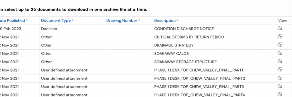
The Phase I report was submitted (CND/347879/21) to partly discharge the contaminated land planning condition, the ‘condition discharge notice’ confirms the recommendations of the report were accepted and the condition partly discharged.