Residential Development, Market Lane, Walpole St Andrew, Wisbech, Norfolk, PE14
Case Study Reference: CS21-04-06
Planning Authority: King's Lynn and West Norfolk Borough Council
Planning Reference: King's Lynn and West Norfolk Borough Council and 19/01068/O
Synopsis:
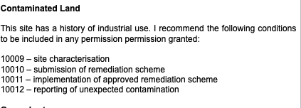 As part of the application the contaminated land team were consulted on the application and the potential for the site to pose a risk to human health, as there is a historical industrial use for the site and the sensitivity of the development a contaminated land planning condition was attached to the decision notice.
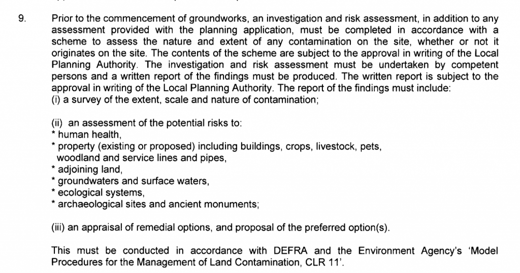
The first stage of discharging the contaminated land planning condition (9) was to prepare 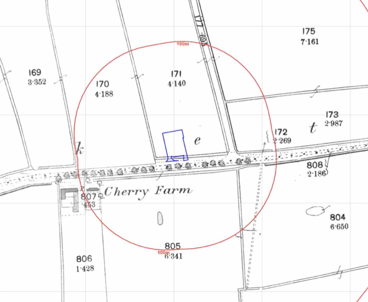 a Phase I desk study report, this assesses the potential for a site to be impacted by using a wide range of sources including Ordnance Survey maps, information provided by regulators (Environment Agency, local authority, Coal Authority, BGS etc.).
The history of the site and the surrounds 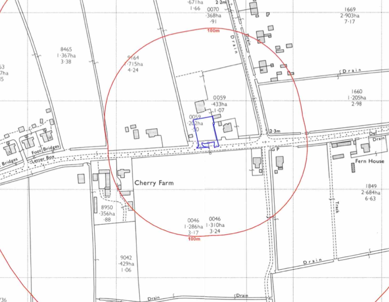 was researched using a combination of historical O.S. maps, aerial plates and street level imagery. Initially the site formed part of an open parcel of land, the site was developed circa 1970 when the site appeared to be associated to the building on the northern boundary.
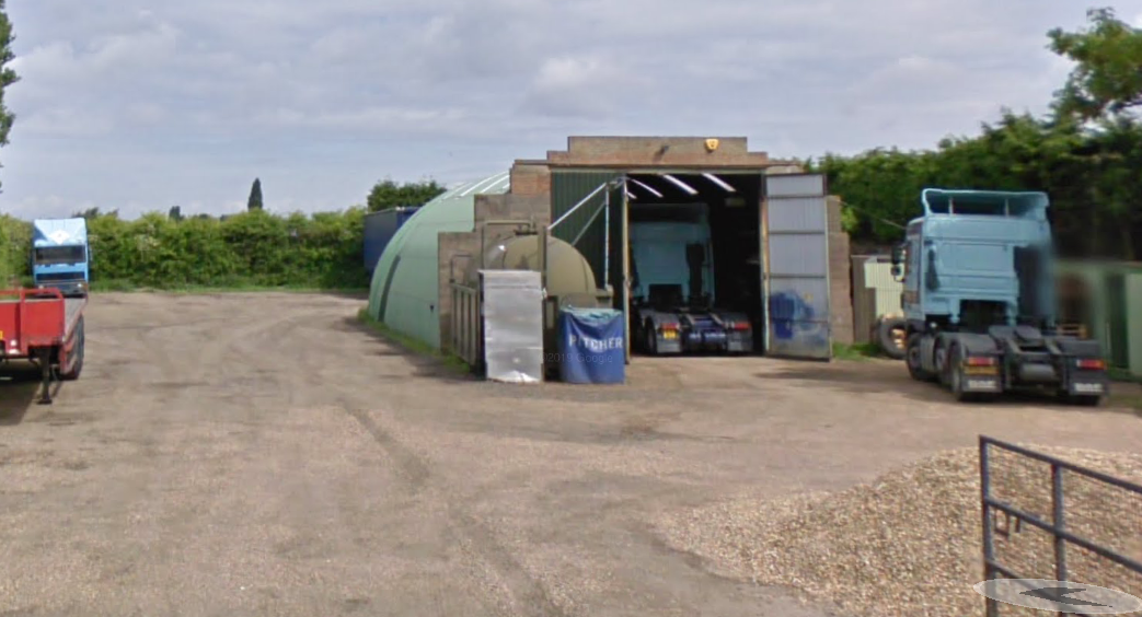
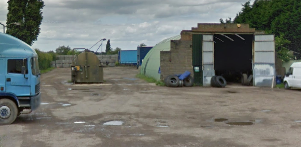
After feedback from the local authority street level imagery were studied and two tanks were noted on the May 2009 and June 2016 images.
A review of the planning history of the site did not reveal any salient information.
The recorded geology was given as Tidal Flat deposits underlain Kimmeridge Clay Formation (mudstone) , no borehole records in the public domain were available through the British Geological Survey.
Prior to the site walkover survey a trial pit had been excavated on the site, this revealed made ground to be present with peat recorded at the base of the trial pit.
Data provided by regulators identified the site formed art fo a dept and the area to the north was occupied by Pitcher Transport.
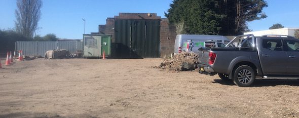
 On completion of the desk based assessment a site walkover visit
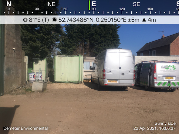
 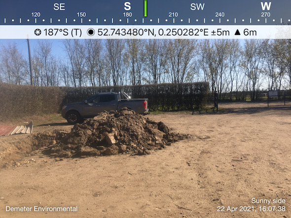 was undertaken, this revealed the site was an open gravelled parcel of land. The tanks identified on the street level imagery were no longer present.
On completion of the site visit a qualitative risk assessment was undertaken in order to determine which of the potential sources warranted further investigation, this concluded that the past land uses, the made ground on site as well as the peat underlying the site posed a potential risk and further works were proposed, remediation as an alternative was proposed for the potential risks relating to ground gases being generated by the peat.
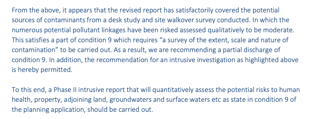
Once the proposals in the Phase I report were accepted the Phase II site investigation could be undertaken, the site investigation was undertaken in May 2022 and comprised of 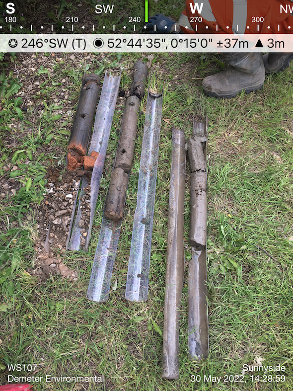 the sinking of six dynamic sampling boreholes on site as well as two targeted boreholes in the footprints of the former tanks to the north of the site.
The investigation confirmed the observations made in the trial pit excavated prior the walkover survey, a layer of made ground underlain by clay and peat.
Hydrocarbon odours were noted in the soils from the positions from the area of the former tanks, this was used to refine the analysis suite for samples from these two locations.
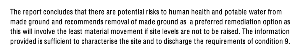
A quantitative assessment was undertaken on the soil chemical data, this indicated that whilst the tanks have not impacted site soils the made ground on site poses a potential risk to human health and to water mains.
In order to break the pollution linkages remediation on the proposed garden and landscaped areas were proposed as well as the specification of water main as barrier pipe. Given that the made ground on site is shallow, removal of the made ground will likely be the preferred option.
The recommendations of the Phase II report were accepted and Condition 9 discharged.