Change Of Use Of An Agricultural Building To A Dwelling, Far Wood Lane ,Greetham, Rutland, LE15
Case Study Reference: CS20-12-05
Planning Authority: Rutland County Council
Planning Reference: Rutland County Council and 2020/1346/PAD
Synopsis:
In order to demonstrate that after the development the site could not be classified as ‘contaminated land’ under Part 2A of the Environmental Protection Act a Phase I desk study report was required to support the application for the erection of a dwelling. The site was occupied by an agricultural building, the past use f the site have the potential to impact site soils.
 A Phase I desk study report assess the potential for a site to be impacted by contamination, this is undertaken by researching the history of the site and the surrounds as well as a review of information held by regulatory bodies and a site visit.
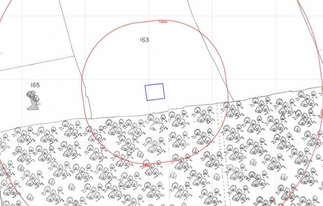
The history of the site and surrounds w ere researched using a combination of Ordnance Survey (O.S.) maps, street level imagery and aerial plates, this revelaed the site was developed circa 1950 , aerial plated indicated the presence of hard-standing.
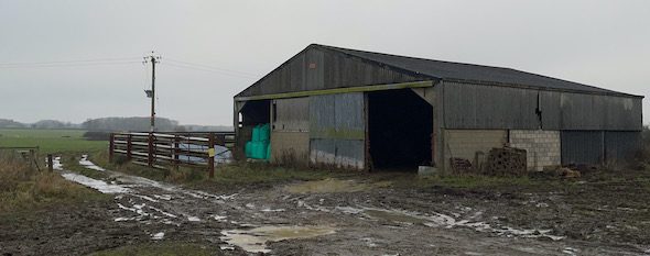
A camp site was noted on the 1950 map to the south west of the site.
The planning history of the site was reviewed, this revealed that a previous application was made to use the site as a maggot farm, which was refused.
The published geological maps identified the draft soils as Till which was underlain by limestone. Data provided by the BGS also identified a sinkhole to be present on the site.
Data provided by regulatory bodies did not reveal any further information.
 On completion of the desk based research a site reconnaissance
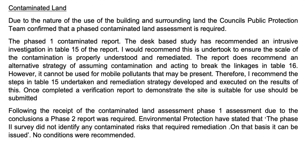
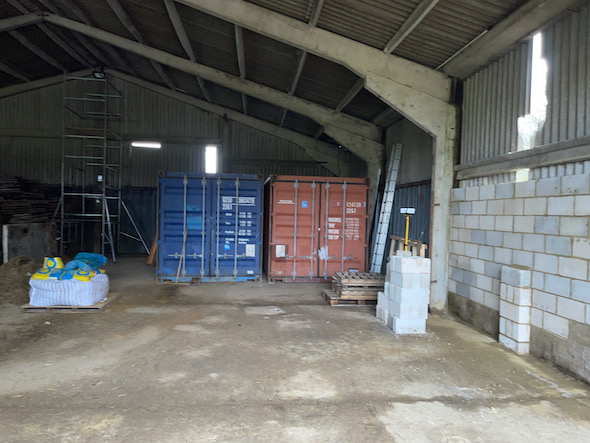
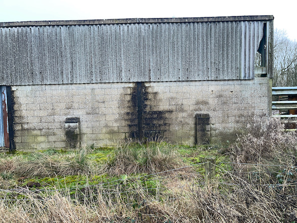 e visit was undertaken, this confirmed the site was a an agricultural building, evidence of staining was noted on the northern face of the building as well as damaged cement sheeting.
On completion of the walkover survey a qualitative risk assessment was undertaken on the potential sources of contamination identified in the desk study report in order to determine if any warranted further investigation, this concluded that the made ground that is likely to be present, the staiing and damaged cement sheeting warranted further investigation and a Phase II site investigation was proposed, the desk study report contained details of the locations and analysis suite to be used.

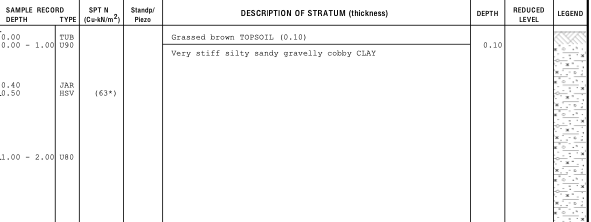 Once the proposals were accepted the Phase II site investigation was started, which comprised of the sinking of a number of dynamic sampling borehole around the site, samples of surface soils were taken for asbestos analysis as well as samples from the area of staining from hydrocarbon analysis.
No olfactory or visual evidence of hydrocarbons were npted in the area around the staining, which was confirmed by the chemical testing, and whilst made ground was present, did not pose a risk to human health.
The risk assessment undertaken as part fo the Phase II report concluded that there were no credible sources of contamination on the site and no further works were proposed.
Whilst not published, the officers report confirms the Phase II report was accepted and the contaminated land planning co ndition discharged.