Erection of a Dwelling, The Crescent, Bromley Cross, Bolton, BL7
Case Study Reference: CS20-11-06
Planning Authority: Bolton Metropolitan Borough Council
Planning Reference: 07688/20 and 12776/21
Synopsis:
 Given the history of the site a contaminated land planning condition was attached to the decision notice for the proposed development.
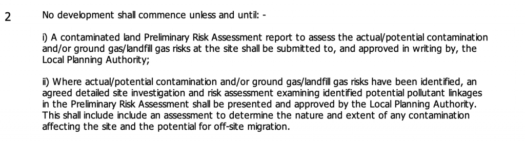
The first stage of discharging the condition was to prepare a Phase I desk study report in order to determine if the site has the potential to be impacted by elevated levels of contamination, and to determine the source as well as the likelihood of the risk occurring.
 A desk study determines what issues relating to historical contamination may affect the site, this is undertaken by reviewing the site history using a combination of O.S. maps, aerial, plates and street level imagery, a review of data held by regulatory bodies (Environment Agency, local authority, BGS etc.) as well as a site walkover survey.
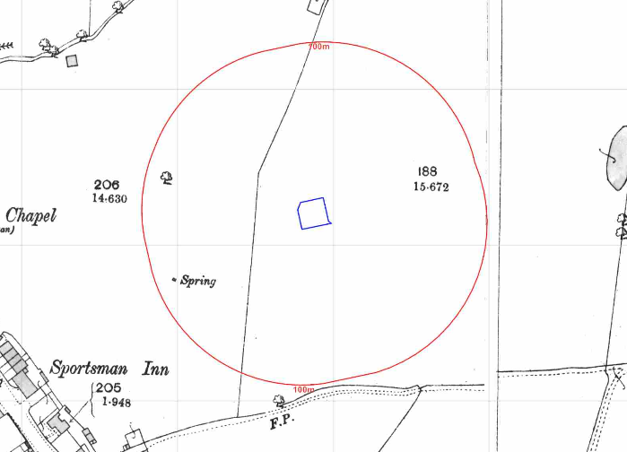
The history of the site and surrounds were researched using a combination of Ordnance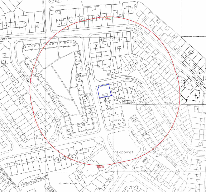 Survey (O.S.) maps, street level imagery and aerial plates, this revealed the site was undeveloped until circa 1955 when the current dwelling was erected. A set of residential garages were noted on the same map 15m south east of the site. Aerial plates indicated the garages were redeveloped prior to 2012.
Street level imagery indicated the site formed part of the gardens of the adjoining dwelling.
The planning history of the site was reviewed as part of the desk based research, no previous applications were noted.
 The published geological maps identified the site as being underlain by Devensian Glaciofluvial Deposits which in turn were underlain by Pennine Coal Measures. Large scale maps also identified deposits of made ground at two locations to the north east of the site.
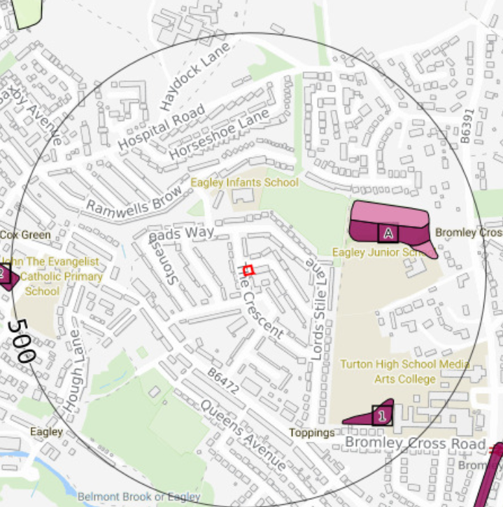
Data provided by regulatory bodies identified a couple of ponds, refuse heap and ground workings within 250m of the site as well as a mill being previously present on the site.
The sensitivity of the groundwater under the site was assessed in order to determine if the site posed a potential risk to groundwater, as there were no abstractions and the site was not near a Source Protection Zone the sensitivity was regarded as very low for both groundwater and surface water bodies.
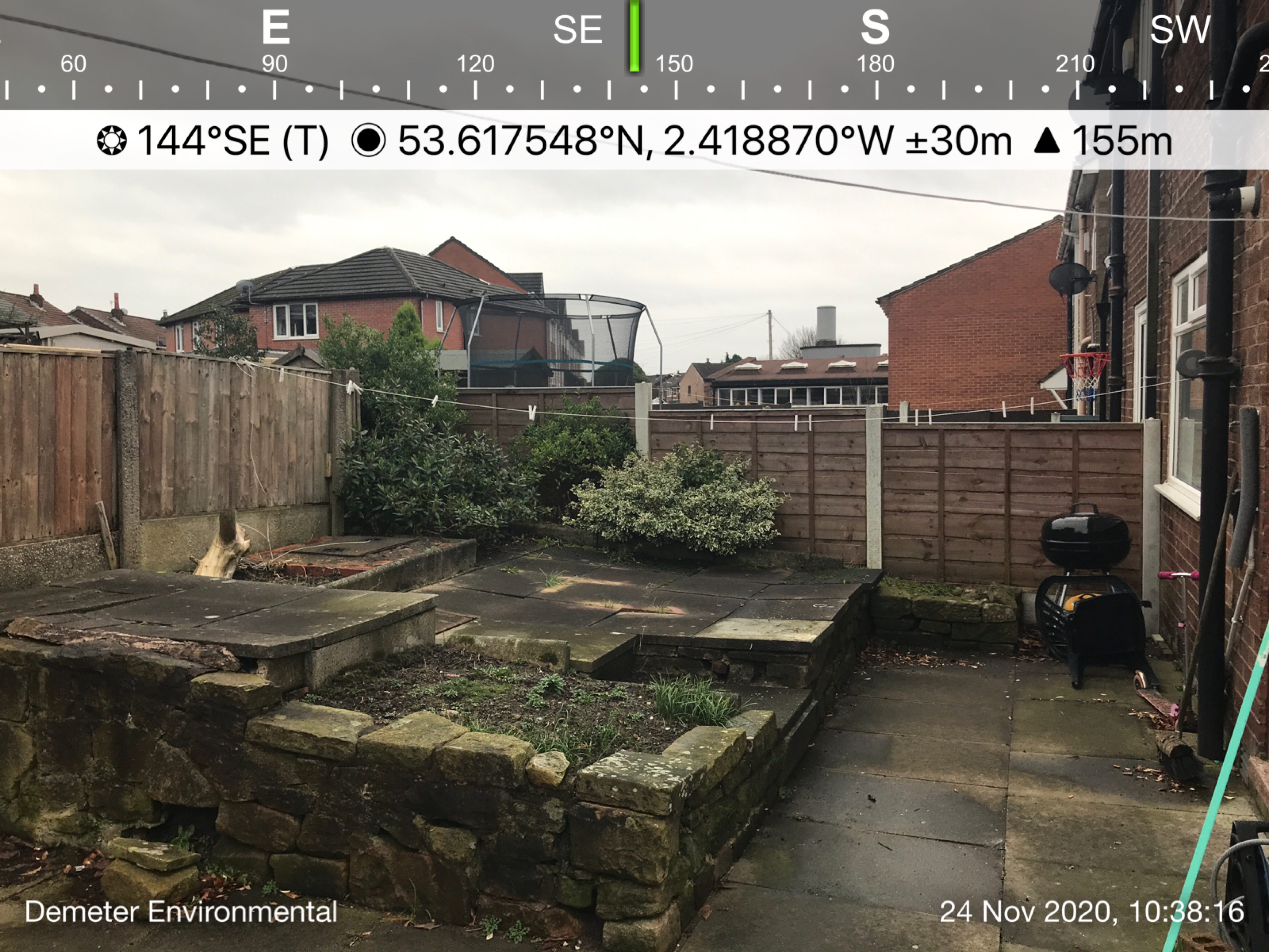 On completion of the desk based research a site reconnaissance
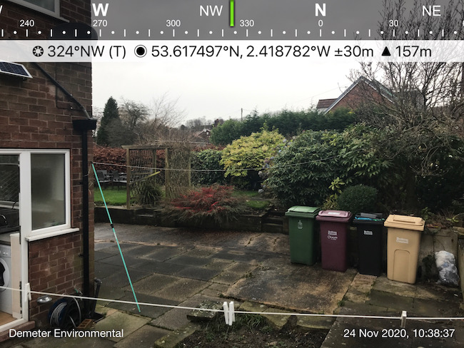 visit was undertaken, this confirmed the site formed part of the garden of the adjoining dwelling.
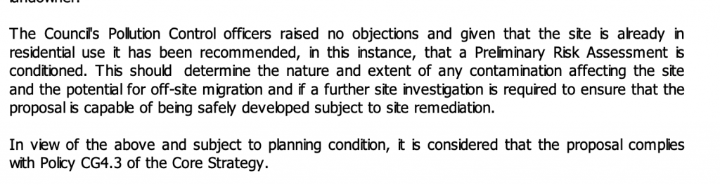
Once the walkover survey was completed a qualitative risk assessment was undertaken on the potential sources of contamination identified in the desk study report in order to determine if any warranted further investigation, this concluded that there were no credible sources and no further works were warranted.
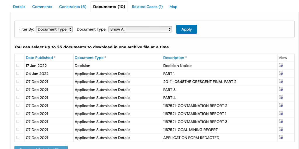
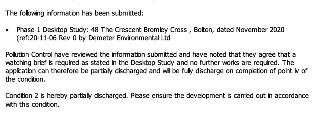
The report was submitted to discharge the contaminated land planning condition (2776/21), the recommendations within the desk study report were accepted and the condition discharged.