
Erection of a Dwelling, Arley Avenue, Bury, BL9
Case Study Reference: 20-01-08
Planning Authority: Bury Metropolitan Borough Council
Planning Reference: Bury Metropolitan Borough Council and 67294
Synopsis:
 Demeter Environmental were initially approached to prepare a desk study report and Coal Mining Risk Assessment in order to provide the potential purchaser information on the potential liabilities associated with the site and in order to support a future planning application.
As the site was within a Development High Risk area as defined by the Coal Authority a Coal Mining Risk Assessment (CMRA) would also be required to support any application in order to demonstrate to the Coal Authority the proposed development was feasible.
Both the desk study report and CMRA were prepared at the same time as the details of the geology affected the assessment in the desk study report.
As part of the CMRA the geology is reviewed and the availability of any borehole in the public domain (BGS boreholes) in close proximity to the site are identified. The geology indicated that deposits of clay would be present above the Lower Coal Measures, no borehole records were available in close proximity of the site.

Information held by the Coal Authority indicated that the Arley coal seam had been worked and was present under the site at 13mbgl.
 The desk study report is an assessment of the potential for a site to be impacted by contamination and is based on a variety of sources including Ordnance Survey maps aerial plates, street level imagery, geological maps and information provided by regulators (Environment Agency, local authority etc.).
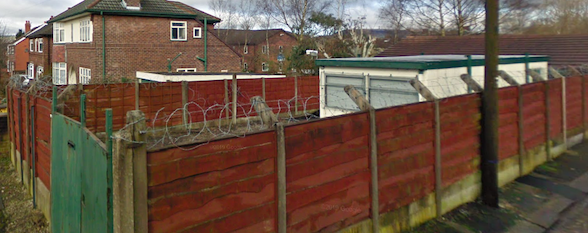
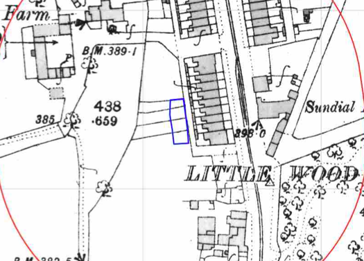
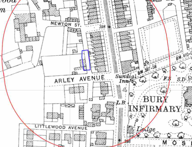
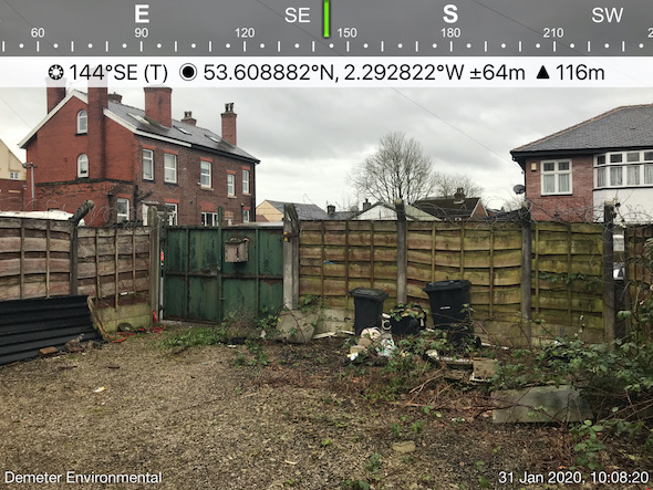
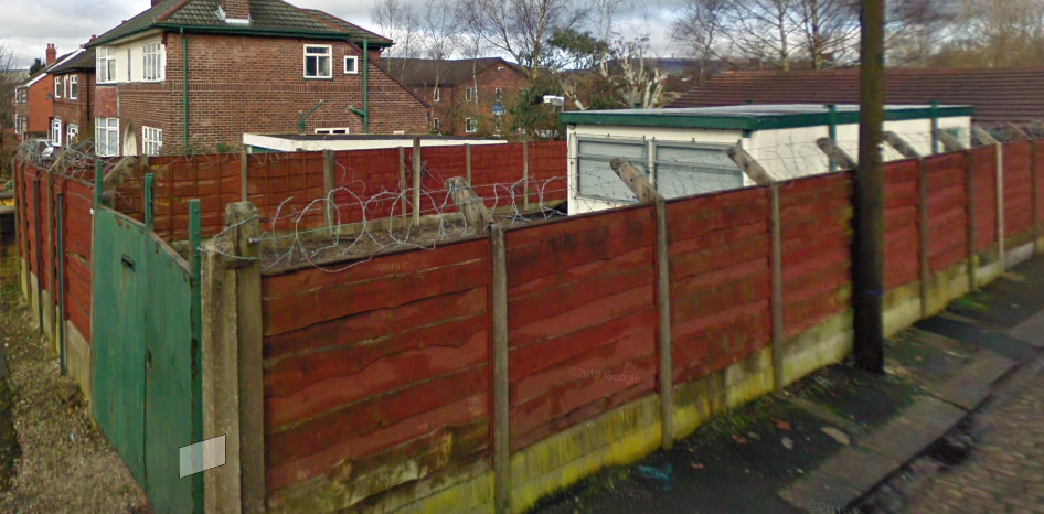
The review of the site history revealed that the site was initially open land until circa 1930 when a building i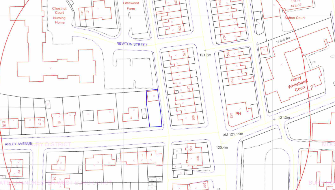 s identified on the site, subsequent maps identify further redevelopment and the street level imagery indicated the site was occupied by portable office.
Data provided by regulators did not provide any salient information.
 On
On 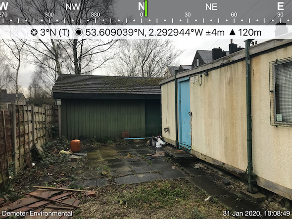 completion fo the desk based part of the report a site reconnaissance visit (walkover survey) was undertaken, this revealed the northern area of the site was occupied by a portable office and a residential garage.
Once the site walkover had been completed a qualitative risk assessment was undertaken in order to determine if any further works were warranted. It was concluded that the made ground on the site and past land uses had the potential to impact site soils and the potential of worked shallow coal seams was also identified as a potential source of contamination.
The CMRA concluded that once planning had been granted a single borehole should be sunk to a nominal depth of 30mbgl with a further two boreholes sunk if any evidence of coal was recorded.
By August 2021 the site had been sold on to another party and planning has bene approved, Demeter Environmental were commissioned to undertaken the works to satisfy the Coal Authority and the works proposed in the desk study report.
 Whilst the Coal Authority permit to drill was being obtained the trial pits on site were excavated,
These confirmed the presence of a thin layer of made ground on the site., samples of the made ground were taken and subject to chemical analysis. The results confirmed the made ground on the site was impacted by elevated levels of contamination.
Once the permit to drill had bene obtained a open hole rotary borehole was sunk, this revealed that 5m of clay was present above the Lower Coal Measures and there was no evidence of coal or voids in the bedrock to a depth of 30mbgl.
Based on this it was concluded that worked coal seams did not pose a risk to ground stability and was not a credible source of ground gases.
On completion of the rotary borehole the permit closure application was completed and returned to the Coal Authority confirming the works had been undertaken.
The Phase II report was revised in line with queries from the Coal Authority and the revised conclusions were accepted by both the Coal Authority and the contaminated land officer.
Once the Phase II report had been accepted the Remediation Strategy (Phase IIIa Implementation Plan) could be prepared, this document goes through how the remediation will be undertaken and demonstrated how the works will be validated.
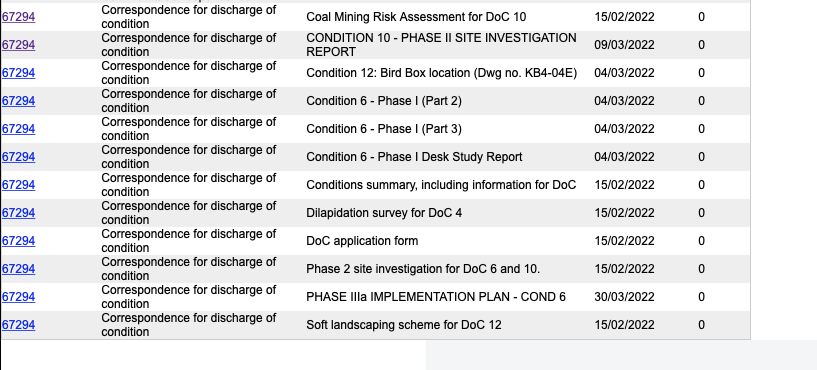
The Phase I, Phase II, CMRA and Phase IIIa reports are all accessible via the documents tab for application 67294.
As of May 2022 the development had commenced and on completion of the remediation the works will be inspected and validated.