
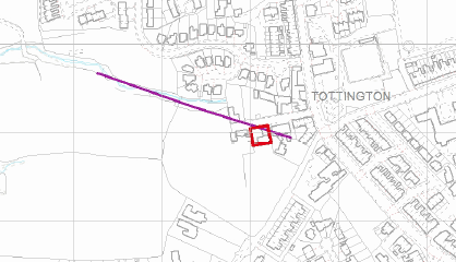
Construction Of One Industrial Unit, Spring Vale Street, Tottington, Bury, BL8
Case Study Reference: CS19-07-08
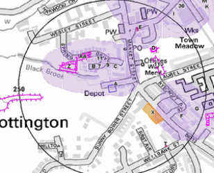
Planning Authority: Bury Metropolitan Borough Council
Planning Reference: Bury Metropolitan Borough Council and 64749
Synopsis:
In order to demonstrate that after the development the site could not be classified as ‘contaminated land’ under Part 2A of the Environmental Protection Act a Phase I desk study report was required to support the application for residential redevelopment of the site.
Also due to the site being within a ‘Development High Risk Area’ the Coal Authority raised an object to the application until the applicant had submitted a Coal Mining Risk Assessment (CMRA).
Demeter Environmental were commissioned to prepare both reports to support the planning application.
 The aim of a CMRA is to identify any coal mining legacy risks and set out a proposed mitigation strategy to demonstrate to the LPA that the site can be made safe and stable for the proposed development. In some cases it may be possible to ensure that the development layout avoids recorded high risk features.
The published geology indicated that the drift soils was Glaciofluvial Deposits. The solid geology was given as the Pennine Lower Coal Measures Formation of the Westphalian Epoch.
The borehole section sheets published by the BGS were reviewed and no boreholes in close proximity to the site were available.
Data provided by the Coal Authority confirmed the site was in an area where unrecorded coal seams were suspected. And an coal seam was suspected to outcrop on the site.
The CMRA concludes that there was a risk to the development from the worked seams and proposed either further investigation. It was proposed that initially a single rotary borehole to 30mbgl would be sunk with a further two if there was evidence of coal seams.
Parallel to the CMRA the Phase I desk study report was prepared. The desk study determines what issues relating to historical contamination may affect the site, this is undertaken by reviewing the site history using a combination of O.S. maps, aerial, plates and street level imagery, a review of data held by regulatory bodies (Environment Agency, local authority, BGS etc.) as well as a site walkover survey.
 The history of the site and surrounds were researched using a combination of Ordnance Survey (O.S.) maps, street level imag
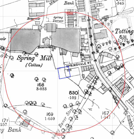
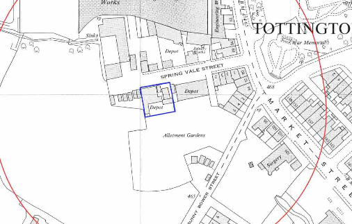 ery and aerial plates, this revealed the site was initially (1850) the site formed part of a larger parcel of open land, by 1910 the site was occupied by a building and by 1930 a number of buildings were present on the site. The 1960 map identified the site as being occupied by a depot. The depot is identified until the 2010 map.
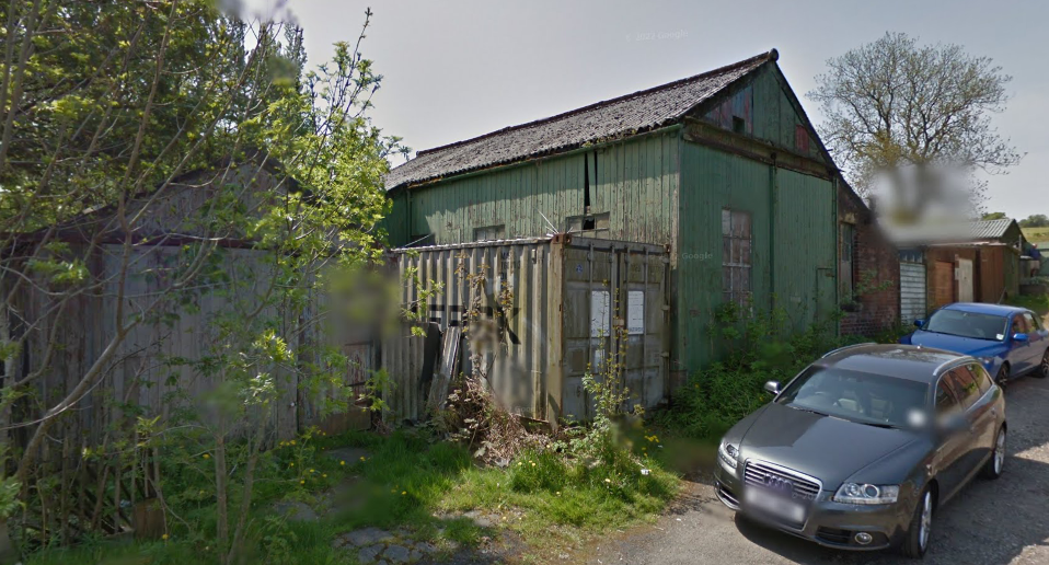
Street level imagery indicates the building on site is a commercial building with corrugated cement sheeting roof.
The planning history of the site was reviewed as part of the desk based research and reports associated with any previous application were located and studied, no previous applications were noted.
The published geological maps gave the drift soils as Glaciofluvial Deposits with the solid geology given as the Pennine Lower Coal Measures Formation (mudstone, siltstone and sandstone) and the Woodhead Hill Rock (sandstone) of the Langsettian Sub- age.
A review of the BGS borehole database indicated no boreholes were available in close proximity to the site.
 Data provided by regulatory bodies confirmed the past uses of the site and the industrial uses of the area in close proximity to the site.
The sensitivity of controlled waters was undertaken to determine if the site posed a risk to the nearby controlled waters, this concluded that as the controlled waters were of low risk due to the site not being within a Source Protection Zone (SPZ), no further assessment was warranted.
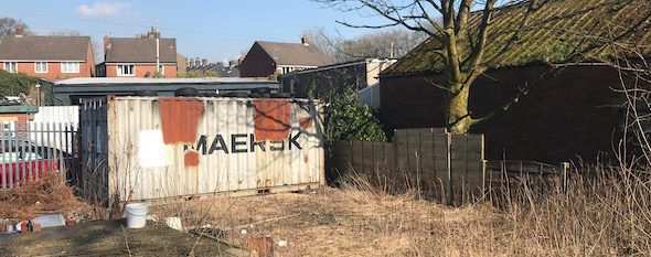
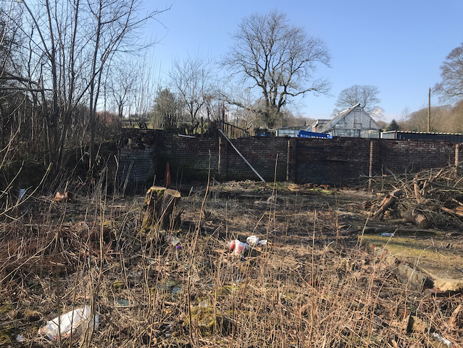 On completion of the desk based research a site reconnaissance visit was undertaken, this confirmed the site had been cleared of overgrowth and the building that had previously been on site had been cleared. The footprint of the former building was raised
 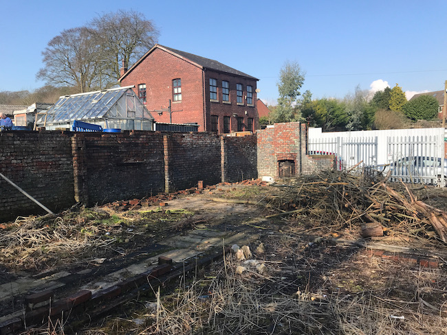 compared to the reminder of the site and wooden flooring was present. A container was present on the north eastern corner and a number of empty containers were present along the northern boundary.
Once the walkover survey was completed a qualitative risk assessment was undertaken on the potential sources of contamination identified in the desk study report in order to determine if any warranted further investigation, this concluded that the potential for made ground to be present on the site, the past uses of the site, in-filled land off site and the potential for worked coal seams under the site all warranted further investigation.
The report concluded that further works were required to assess the potential for the site soils to pose a risk with either monitoring or the incorporation for gas protection measures proposed.

Both reports were submitted to support the application, the recommendations of the CMRA were accepted.

 Once planning was granted the Coal Mining Investigation was
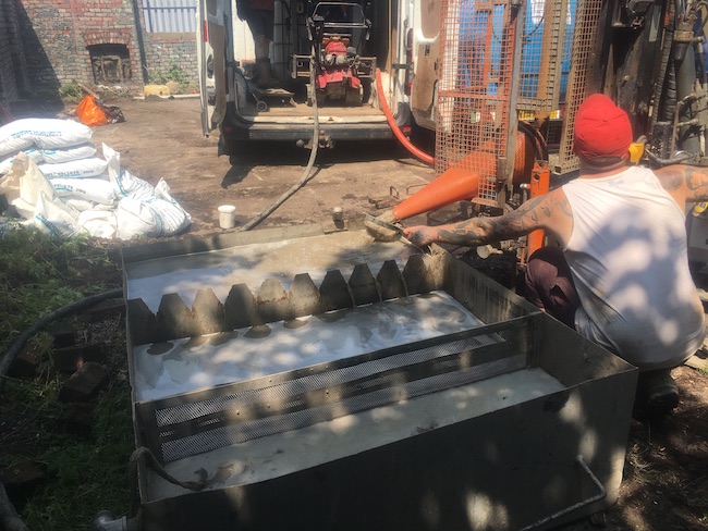 undertaken. The investigation was undertaken in September 2022, the initial borehole proved bedrock at 4mbgl with no evidence of coal in the upper 30m, it was concluded that the risk from worked seams were negligible and no further assessment was warranted.
The correspondence from the Coal Authority confirm the recommendations of the site investigation were accepted and the condition discharged.


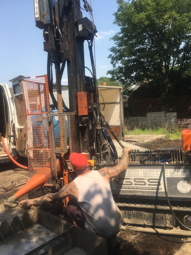
Whilst the permit to drill was being processed by the Coal Authority the site investigation to determine if the site soils posed a risk to human health was undertaken. This comprised of the excavation of three trial pits across the site in order to obtain samples for chemical analysis.
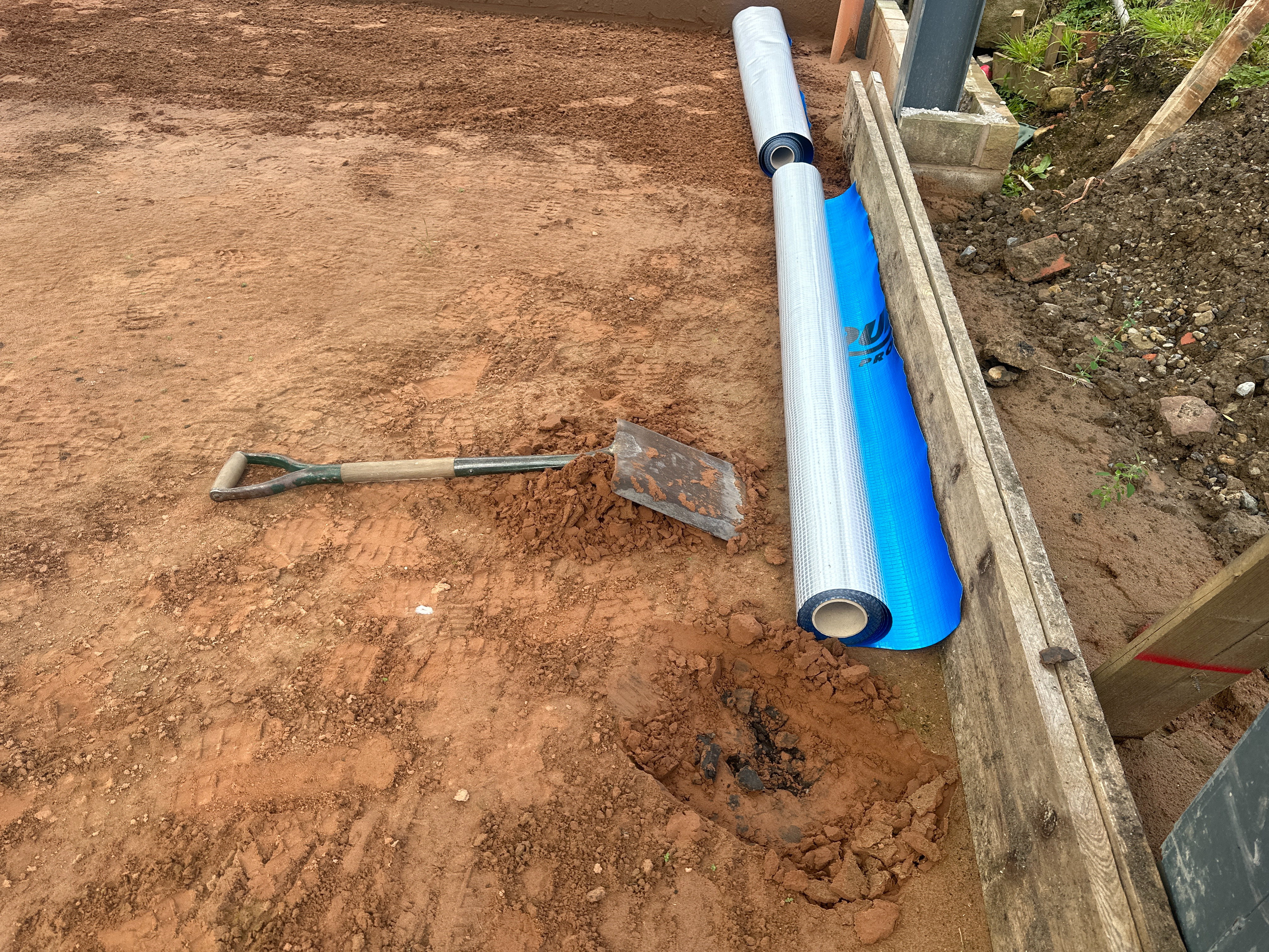
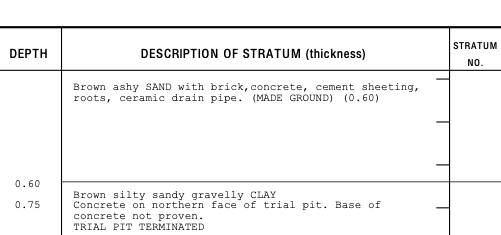 The assessment of the chemical data confirmed the made ground on the site was impacted by elevated concentrations of lead, in order to break the pollution linkages associated with the made ground it was proposed that a 300mm cover underlain by a geotextile was placed on landscaped areas.
Once approval of the Phase II and Coal mining investigation had been given the design of the gas protection measures and the cover system could commence.


In order to discharger the final pre commencement condition associated with the
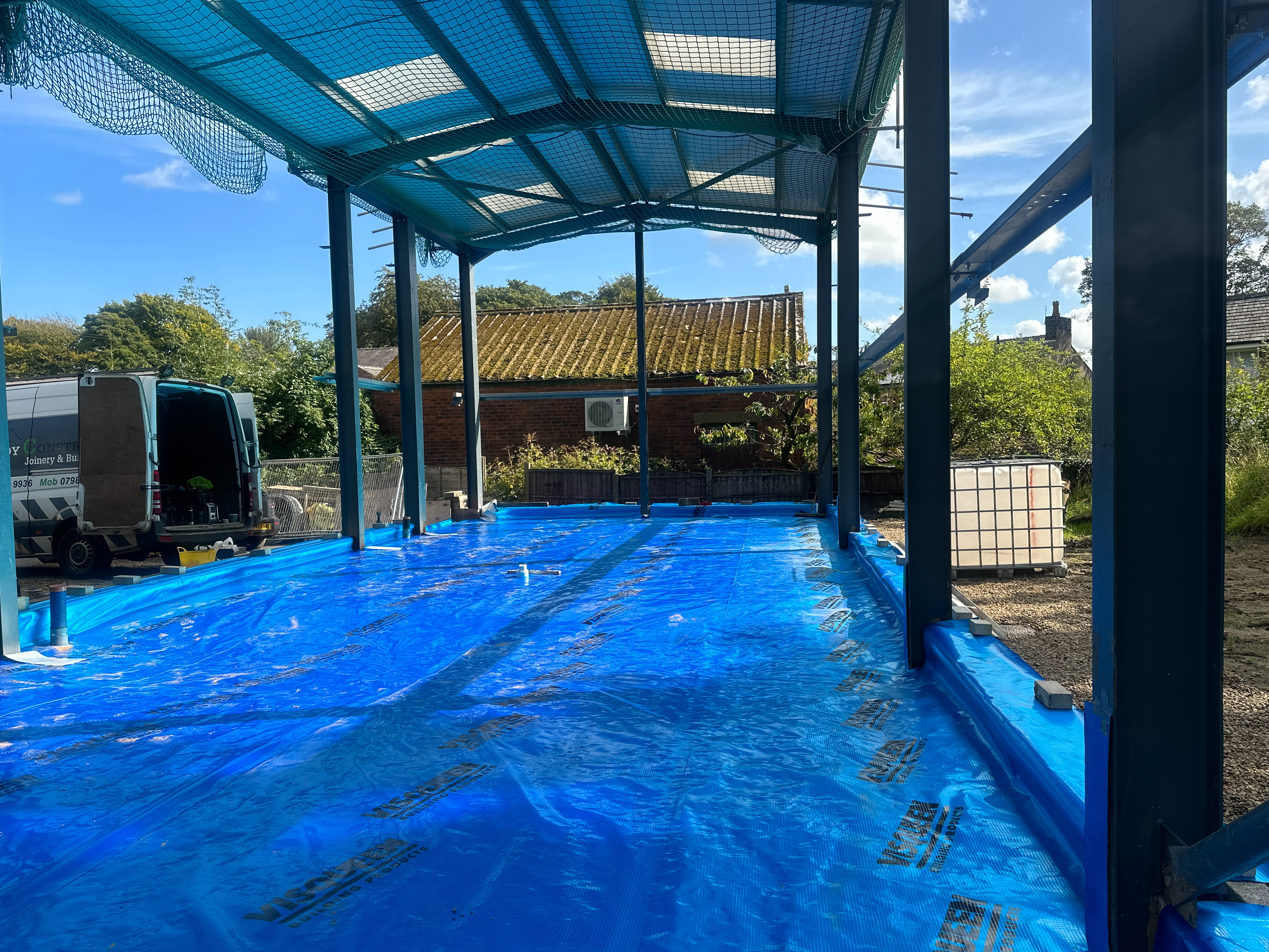
contaminated land planning condition a Phase IIIa remediation strategy / Implementation Plan was prepared which included the specification of the gas resistant me
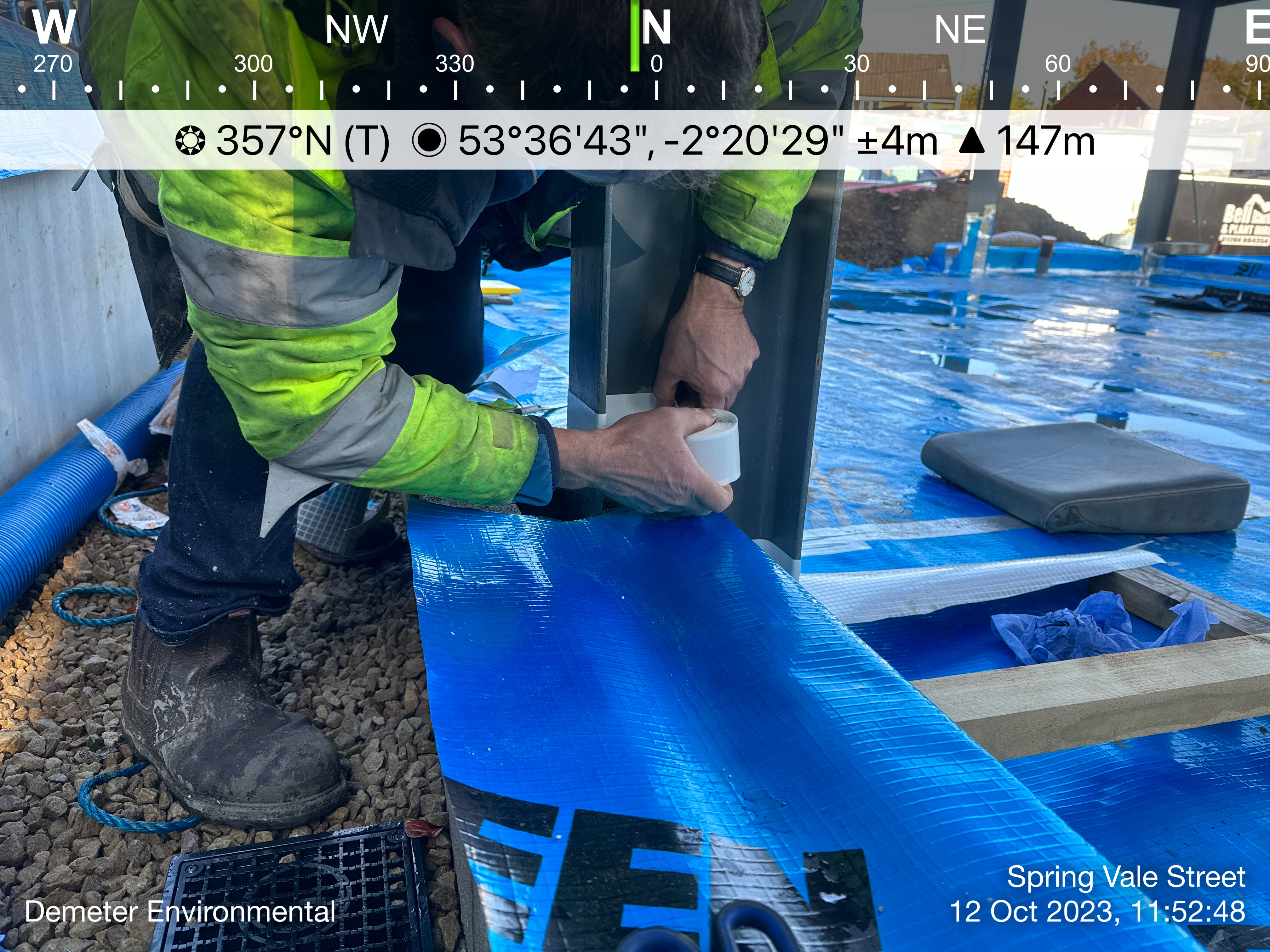
mbrane, geotextile, topsoil etc as well as justification of the sufficiency of the gas protection measures and validation regime.
The gas protection measures were installed in September 2023 and the completion report is yet to be submitted to the local authority to discharge the contaminated land planning condition.