Change Of Use Of A Storage And Distribution Building To A Dwelling, Brand Road, Great Barton, IP31
Planning Reference:
Synopsis:
In order to demonstrate that after the development the site could not be classified as ‘contaminated land’ under Part 2A of the Environmental Protection Act a Phase I desk study report was required to support the application for residential redevelopment f the site.
 A desk study determines what issues relating to historical contamination may affect the site, this is undertaken by reviewing the site history using a combination of O.S. maps, aerial, plates and street level imagery, a review of data held by regulatory bodies (Environment Agency, local authority, BGS etc.) as well as a site walkover survey.
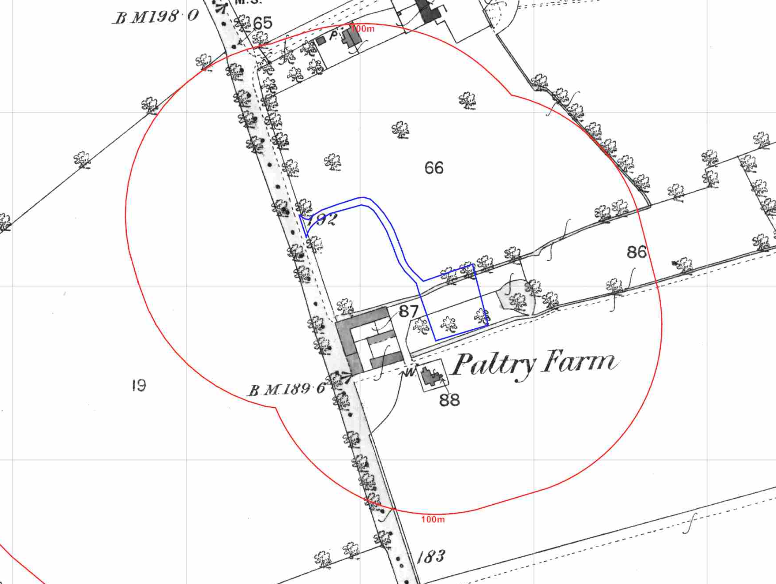
The history of the site and surrounds were researched using a combination of Ordnance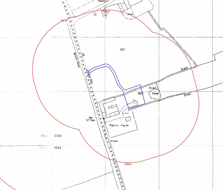 Survey (O.S.) maps, street level imagery and aerial plates, this revealed the site formed part of Paltry Farm from before the first edition O.S. map, a pond was noted 10m north west of the site and a moat 160m north of the site.
The planning history of the site was reviewed as part of the desk based research and reports associated with any previous application were located and studied, 15 previous applications were noted however the planning statement indicates the building has been used by a toner cartridge recycling company, R & R Supplies Ltd with the business based at Paltry Farm for 12 years. It involved receiving old printer cartridges in the post, sorting by make and then distributing them back to the manufacturers.
The published geological maps identified the site as being underlain by head which in turn was underlain by chalk. The borehole section sheets published by the BGS were reviewed and a borehole 38m south west of the site recorded 14m of drift (head) to bedrock (chalk).
Data provided by regulatory bodies did not identify and further salient information.
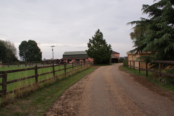
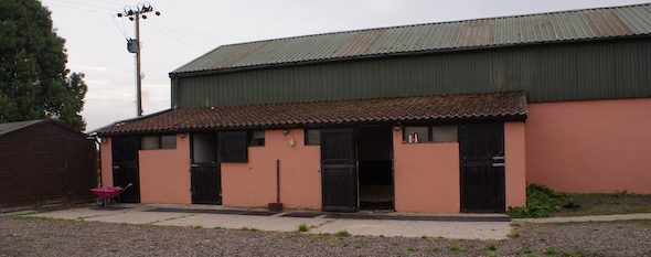
On completion of the desk based research a site reconnaissance 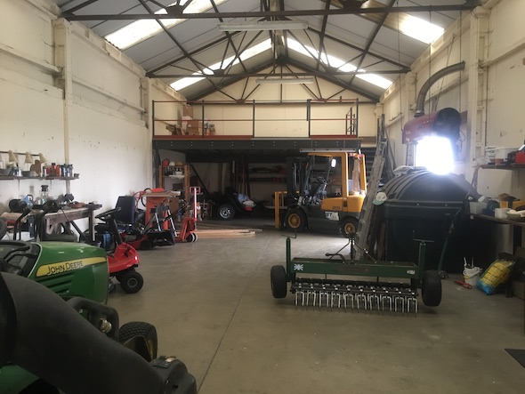 visit was undertaken in order to obtain further information on the potential sources identified in the desk based research and to identify any other potential sources. The walkover survey confirmed the site was occupied by an agricultural building with lean-to stables and lean-to greenhouse. A small detached shed used as a hay store was also on site.
The northern area of the site was a gravelled yard area. A landscaped area was present in the eastern section of the site. A self bunded plastic fuel tank was noted within the building, during the walkover survey the client had confirmed the two former tanks were replaced due to fuel theft.
Once the walkover survey was completed a qualitative risk assessment was undertaken on the potential sources of contamination identified in the desk study report in order to determine if any warranted further investigation, this concluded tha the former tanks and made ground on the site posed a potential risk and further works were proposed to investigate the pollution linkages associated with these sources.
The report was submitted to support the application, the recommendations in the report were accepted and the application granted.