Residential Development, Wisbech Road March Cambridgeshire
Case Study Reference: 14-02-08
Planning Authority: Fenland District Council
Planning Reference: F/YR13/0577/F and F/YR14/3044/COND
Synopsis:
Given the sensitive nature of the development (residential) and the history of the site a contaminated land planning condition was attached to the decision notice for the proposed development.
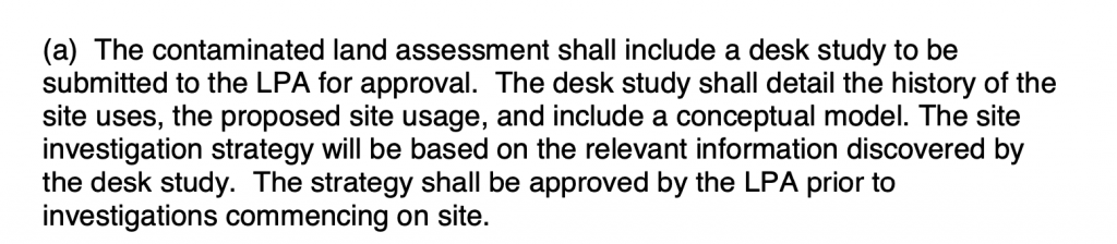
 The first stage of discharging the condition was to prepare a Phase I desk study report in order to determine if the site has the potential to be impacted by elevated levels of contamination, and to determine the source as well as the likelihood of the risk occurring.
A desk study determines what issues relating to historical 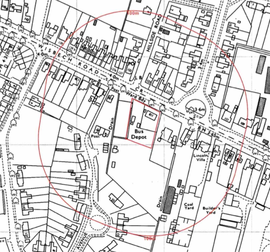 contamination may affect the site, this is undertaken by reviewing the site history using a combination of O.S. maps, aerial, plates and street level imagery, a review of data held by regulatory bodies (Environment Agency, local authority, BGS etc.) as well as a site walkover survey.
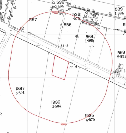
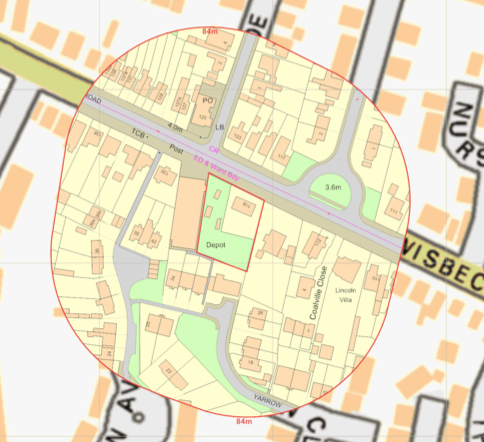 The history of the site and surrounds were researched using a combination of Ordnance Survey (O.S.) maps, street level imagery and aerial plates, this revealed the site was initially developed circa 1925 when dwellings were noted on the site. The site was further developed circa 1962 when the site was occupied by a dept, subsequent maps identified the dept as a bus depot.
A number of ponds as well as a builders yard, coal yard and a warehouse were noted in close proximity to the site.
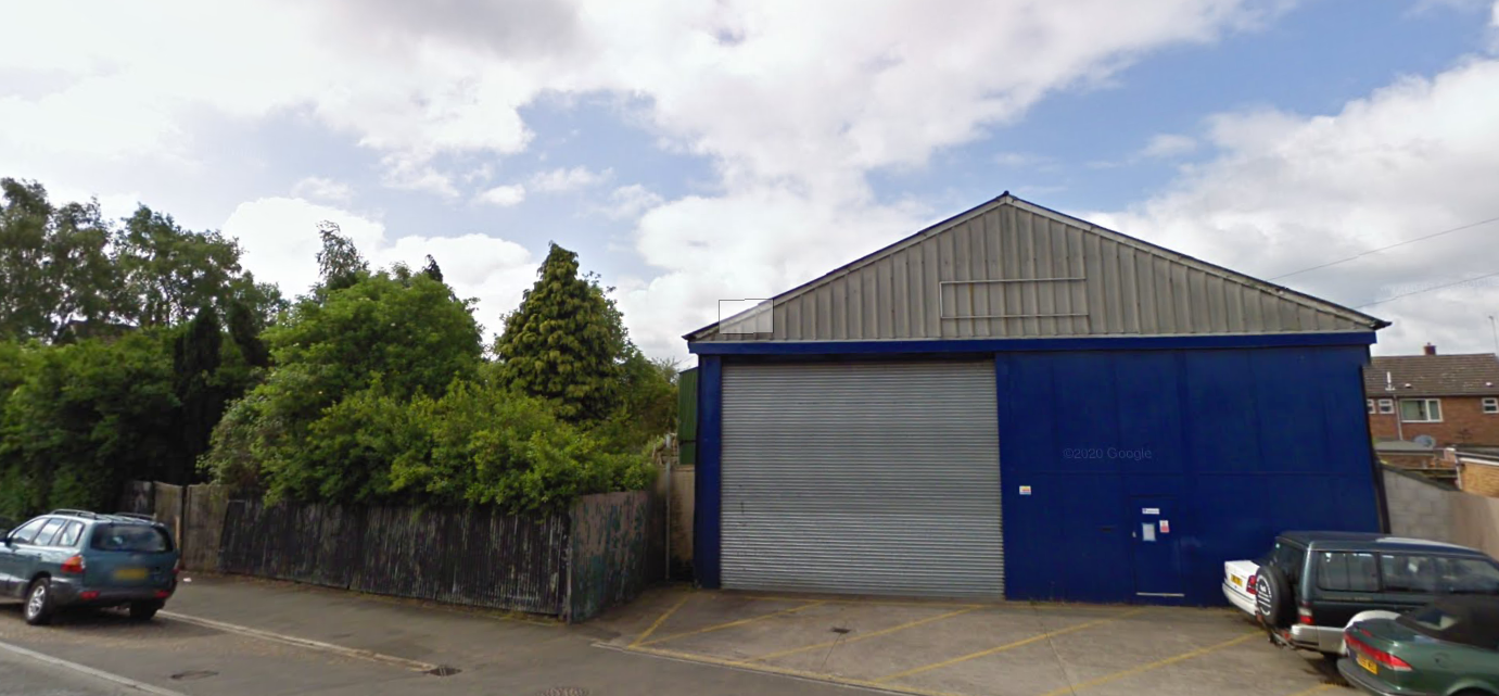
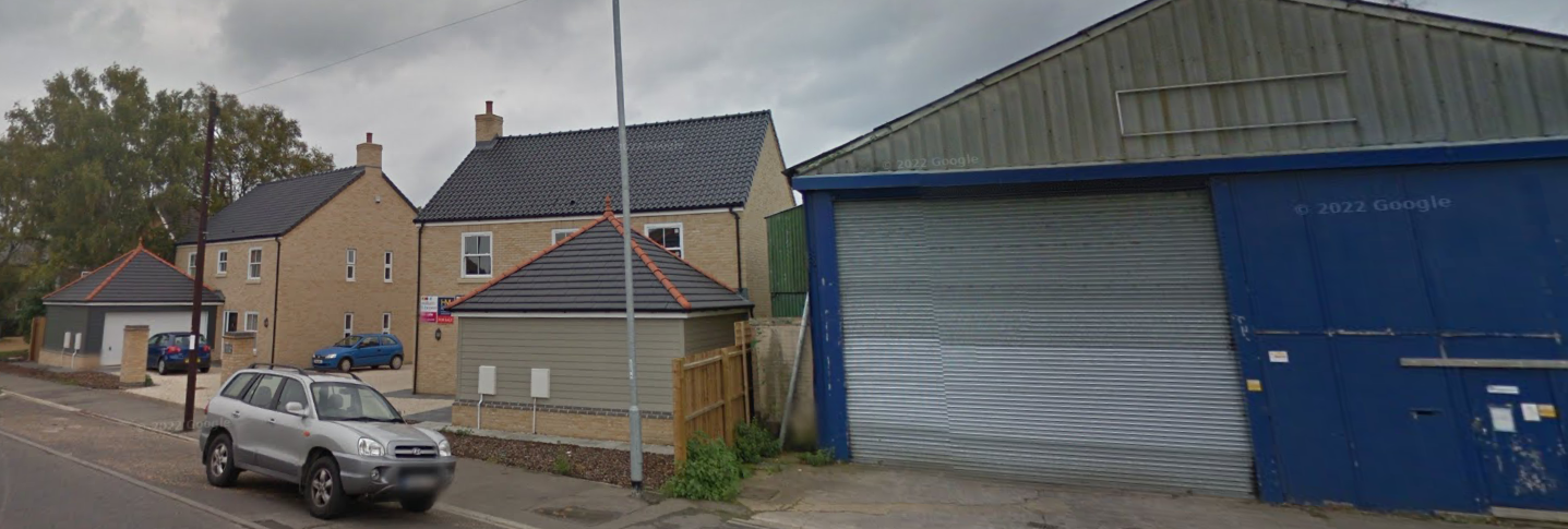
Street level imagery confirmed the site was occupied by a industrial building and open land.
The planning history of the site was reviewed as part of the desk based research, two previous applications for the residential redevelopment of the site were noted. The reports associated with any previous application were located and studied, no salient information was obtained.
The published geological maps identified the site as tidal flat deposits which in turn was underlain by the West Walton Formation And Ampthill Clay Formation. No BGS borehole were available in close proximity to the site to provide further information on the ground conditions.
Data provided by regulatory bodies identified the depot on the site as well as a pollution incident 40m east of the site.
 On completion of the desk based research a site reconnaissance
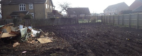
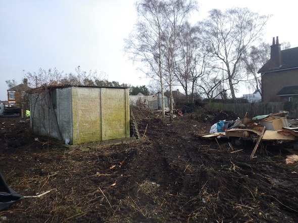
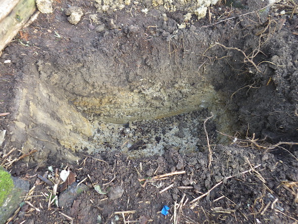 visit was undertaken, at the time of the survey the site had been partly cleared, a part demolished building and a residential garage .
As part of the walkover survey two hand held trial pits were excavated on the open area of the site, no made ground was recorded and the recorded geology confirmed the documented geology.
Once the walkover survey was completed a qualitative risk assessment was undertaken on the potential sources of contamination identified in the desk study report in order to determine if any warranted further investigation, this concluded that the sue of the site as a dept and the potential of asbestos from cement sheeting warranted further assessment.
As part of the walkover survey samples of the soils from the trial pits and subject to hydrocarbon (TPHCWG) analysis the results demonstrated that the site was not impacted by hydrocarbons. This removed the depot as a credible source of contamination and the report concluded that no further works were warranted.
Surface samples were also collected and subject to an asbestos screen, as all results were negative this demonstrated the site was not impacted by asbestos.

The report was submitted (F/YR14/3044/COND) in order to discharge the contaminated land planning condition, the conclusions of the report were accepted and the condition discharged.