Erection of Three Commercial Units,
Case Study Reference: 13-10-04
Planning Authority: Rochdale Metropolitan Borough Council
Planning Reference: 13/01145/FUL and 14/00340/DOC
Synopsis:
Given the the history of the site a contaminated land planning condition was attached to the decision notice for the proposed development.
The first stage of discharging the condition was to prepare a Phase I desk study report in order to determine if the site has the potential to be impacted by elevated levels of contamination, and to determine the source as well as the likelihood of the risk occurring.
 A desk study determines what issues relating to historical contamination may affect the site, this is undertaken by reviewing the site history using a combination of O.S. maps, aerial, plates and street level imagery, a review of data held by regulatory bodies (Environment Agency, local authority, BGS etc.) as well as a site walkover survey.
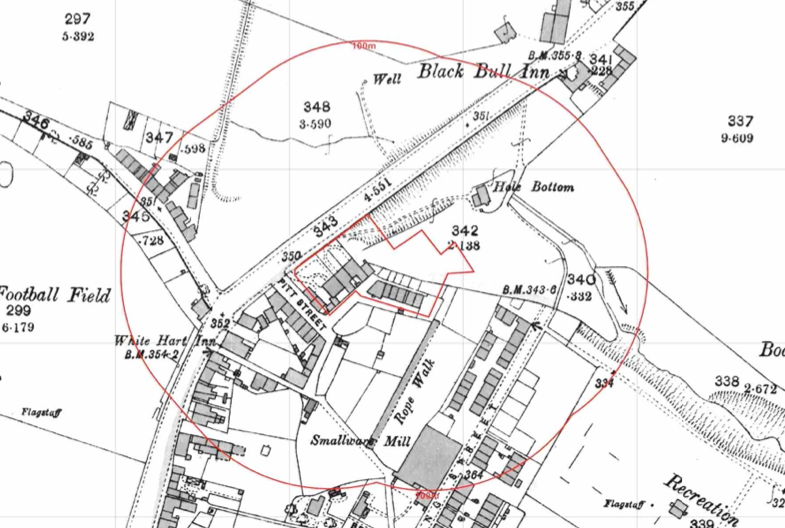
The history of the site and surrounds were researched using a combination of Ordnance 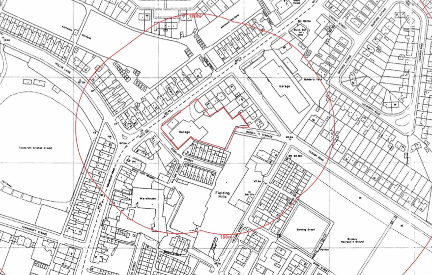 Survey (O.S.) maps, street level imagery and aerial plates, this revealed the site had been developed prior to the first edition O.S. maps with later editions identifying an excavation on the site as well as dwellings. By 1954 the site was occupied by a garage.
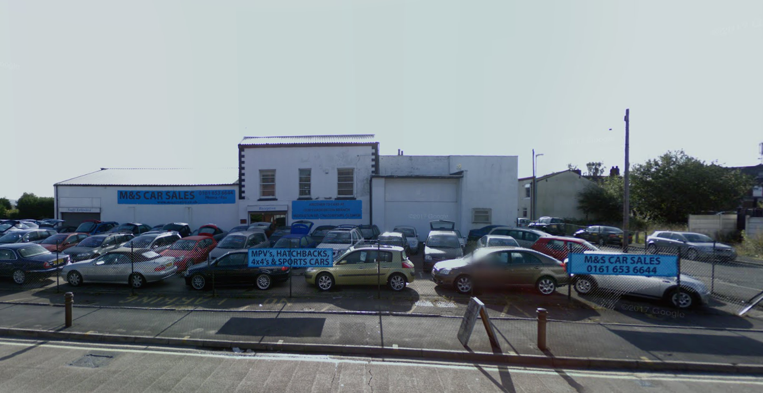
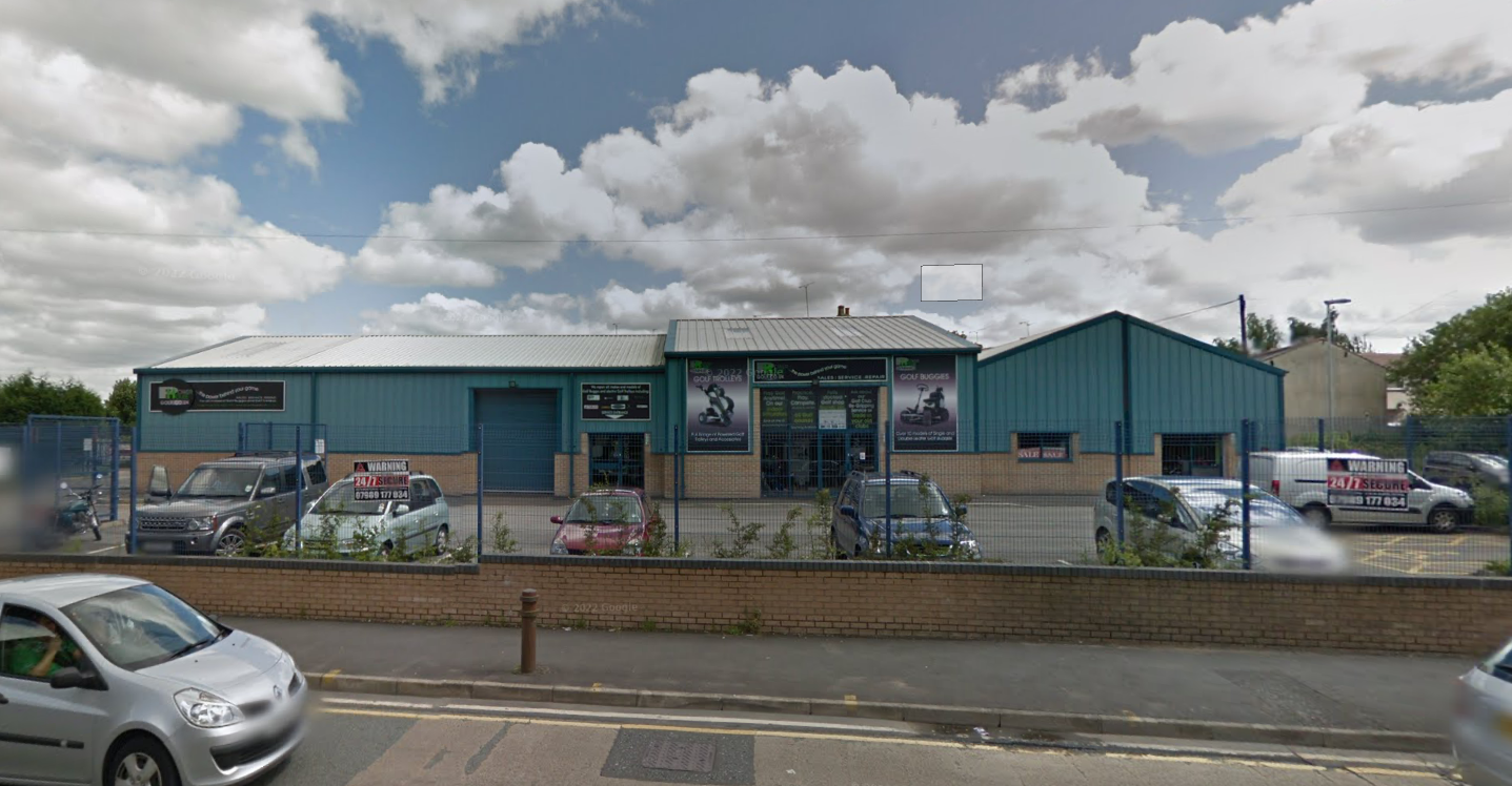
Street level imagery indicated the site was being used for car sales in October 2008. The 2012 image indicates the site had been redeveloped.
The O.S. maps also identified a number of potentially contaminative land uses in close proximity to the site including a rope works, mill and a number of excavations.
The planning history of the site was reviewed as part of the desk based research, four previous applications were noted, the reports associated with any previous application were located and studied, no salient information was obtained.
The published geological maps identified the site as being underlain by Devensian Glaciofluvial Deposits which in turn were underlain by Pennine Coal Measures.
 On completion of the desk based research a site reconnaissance
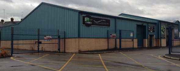
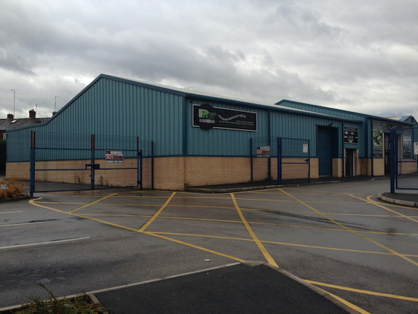
 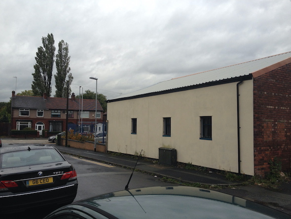 visit was undertaken, this confirmed the site was occupied by three commercial units and associated parking.
Once the walkover survey was completed a qualitative risk assessment was undertaken on the potential sources of contamination identified in the desk study report in order to determine if any warranted further investigation, this concluded that the past uses of the site and the potential for made ground to be present on the site warranted further assessment.
Given the low sensitivity fo the development (commercial) remediation in lieu of further works were proposed.
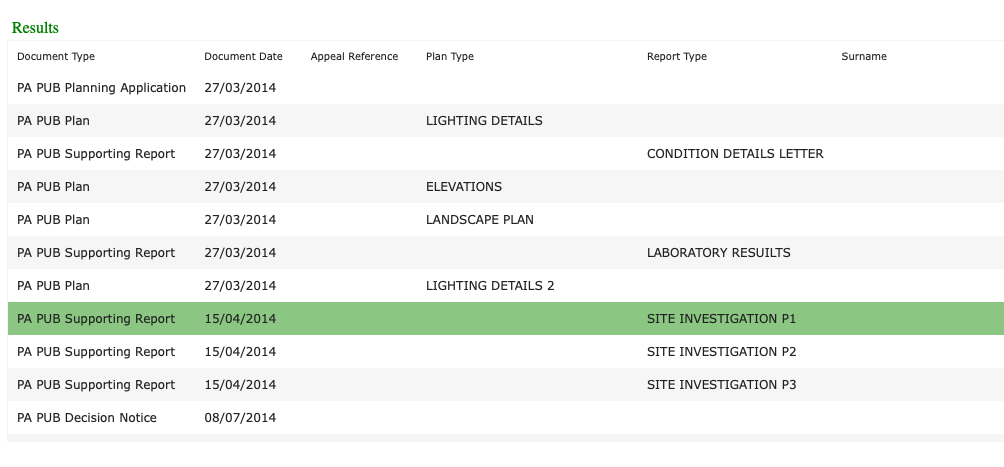
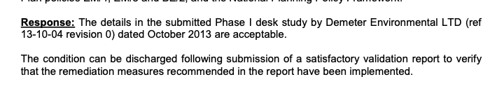
The report was submitted to discharge the contaminated land planning condition (14/00340/DOC), the recommendations were accepted and the condition discharged.