
Erection of a Detached Dwelling, Whittle-Le-Woods, Chorley
Case Study Reference: 10-11-05
Planning Authority: Chorley Council
Planning Reference: 07/01099/FU and 10/01077/DIS
Synopsis:
Given the sensitive nature of the development (residential) and the history of the site, a contaminated land planning condition was attached to the decision notice for the proposed development.

The first stage of discharging the condition was to prepare a Phase I desk study report in order to determine if the site has the potential to be impacted by elevated levels of contamination, and to determine the source as well as the likelihood of the risk occurring.
 A desk study determines what issues relating to historical contamination may affect the site, this is undertaken by reviewing the site history using a combination of O.S. maps, aerial, plates and street level imagery, a review of data held by regulatory bodies (Environment Agency, local authority, BGS etc.) as well as a site walkover survey.
The history of the site and surrounds were researched using  a combination of Ordnance Survey (O.S.) maps, street level imagery and aerial plates, this revealed the site was undeveloped until the 1962 map.
The published geological maps identified the drift soils Devensian Till which was underlain Millstone Grit.
Data provided by regulatory bodies did not reveal any further information.

On completion of the desk based research a

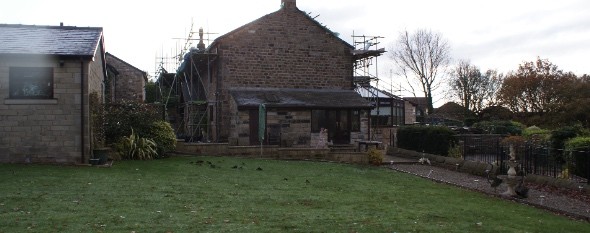
site reconnaissance visit was undertaken, this confirmed the site comprised of part of the garden of the adjacent property.
As part of the walkover survey, a number of hand held boreholes were sunk and the absence of made ground on the site was demonstrated.
On completion of the walkover survey a qualitative risk assessment was undertaken on the potential sources of contamination identified in the desk study report in order to determine if any warranted further investigation, this concluded that there were no credible sources of contamination and that no further assessment was warranted.

The report was submitted to discharge the contaminated land planning condition (10/01077/DIS), the memo from environmental services confirming the report was accepted.
