
Residential Development at Woodbury Close, Croydon, London
Case Study Reference: 12-02-03
Planning Authority: London Borough of Croydon
Planning Reference: 11/00592/P and 12/01134/RES
Synopsis:
Due to the close proximity of a railway line to the site a contaminated land planning condition was attached to the proposed development.
The first stage of discharging the condition was to prepare a desk study report, which is a review of the history of the site and its surrounds (using a combination of Ordnance Survey maps, aerial plates and street level imagery) as well as information held by regulators (Environment Agency, local authority , BGS etc.).
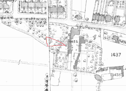 The review of the site history revealed the site formed part of what was later identified as ‘Woodbury Farm’; and by 1932 the site formed part of the rear gardens of three dwelling. The site was separated from the
 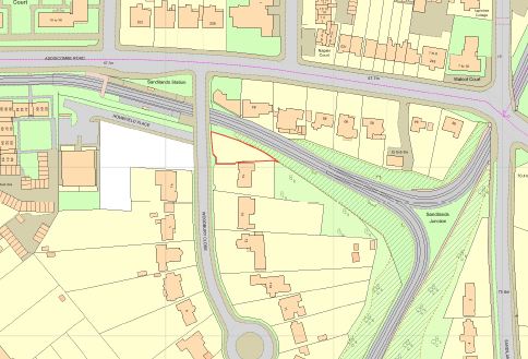 dwellings between 1995 and 2011 when a railway line split the site from the dwellings. A review of aerial palates confirm the railway line was built prior to 2002, an internet search confirmed the line was active form 2000.
The data provided by regulators identified a number of cuttings associated with railway lines as well as a number of ponds.
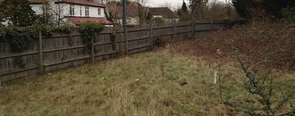
On completion of the desk based assessment a site walkover survey was undertaken, this revealed the site comprised of an open parcel of land.
. A qualitative risk assessment was undertaken to assess the risk posed by the potential sources identified in the desk study, which concluded that the risk of each potential source was either low or none, hence the report concluded that no further works were required.
The desk study report (identified as ‘Phase 1 Desk Study Report – 12-02-03-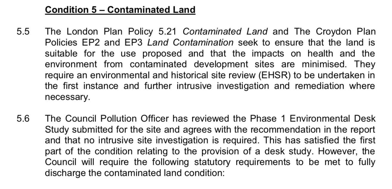 and_Adjacent_to_14_Woodbury_Close_FINAL_Pa’ dated 8th May 2012 was formally submitted to Croydon Council on the 25th April 2012 with application 12/01134/RES alongside the memo accepting the report (‘Environmental Planning Assessment’ dated 11th May 2012)